
For the final part of our South Island road trip we drive a loop from Blenheim down the Kaikoura coast road, across to the spa town of Hanmer Springs, then back up to Blenheim via the old Acheron Road. The old Acheron road turned out to be one of the unexpected and unplanned highlights of our South Island road trip. A spectacular drive through the highlands of Marlborough, learning the history of the musterers as we followed their stock route across the largest cattle station in New Zealand.
Blenheim to Kaikoura – the Coastal Route
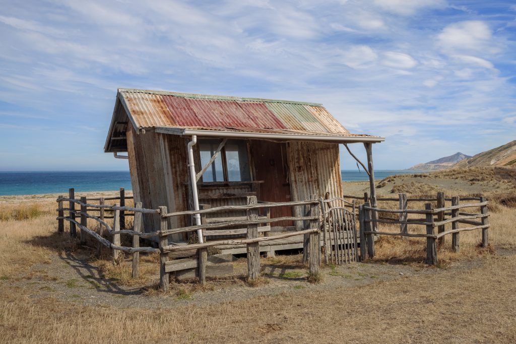
We pass through Blenheim and I stare wistfully out the window at the vineyards and inviting cellar door signs that we pass. I am mentally kicking myself that I had not paid more attention to our trip plan and requested a vineyard tour. Our plan is to spend the next two nights at Cape Campbell at the old lighthouse keeper’s cottage. We have timed it for the perfect night sky to be on show above the lighthouse. We drive 15km of gravel roads through the property with the quirky map that was left for us by the owners pointing out local features such as the crooked beach hut, intentionally designed and built to be crooked by a relative of theirs.
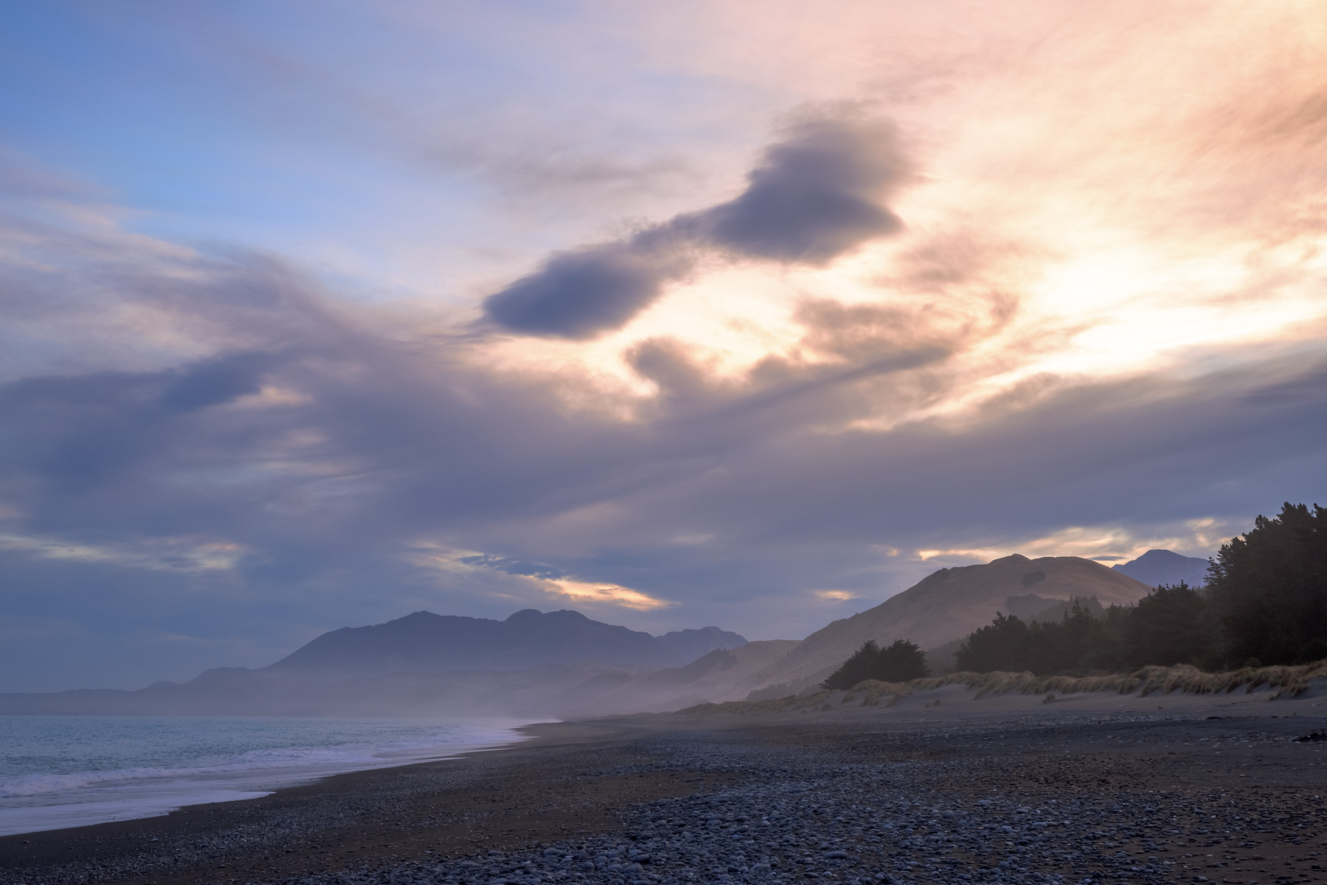
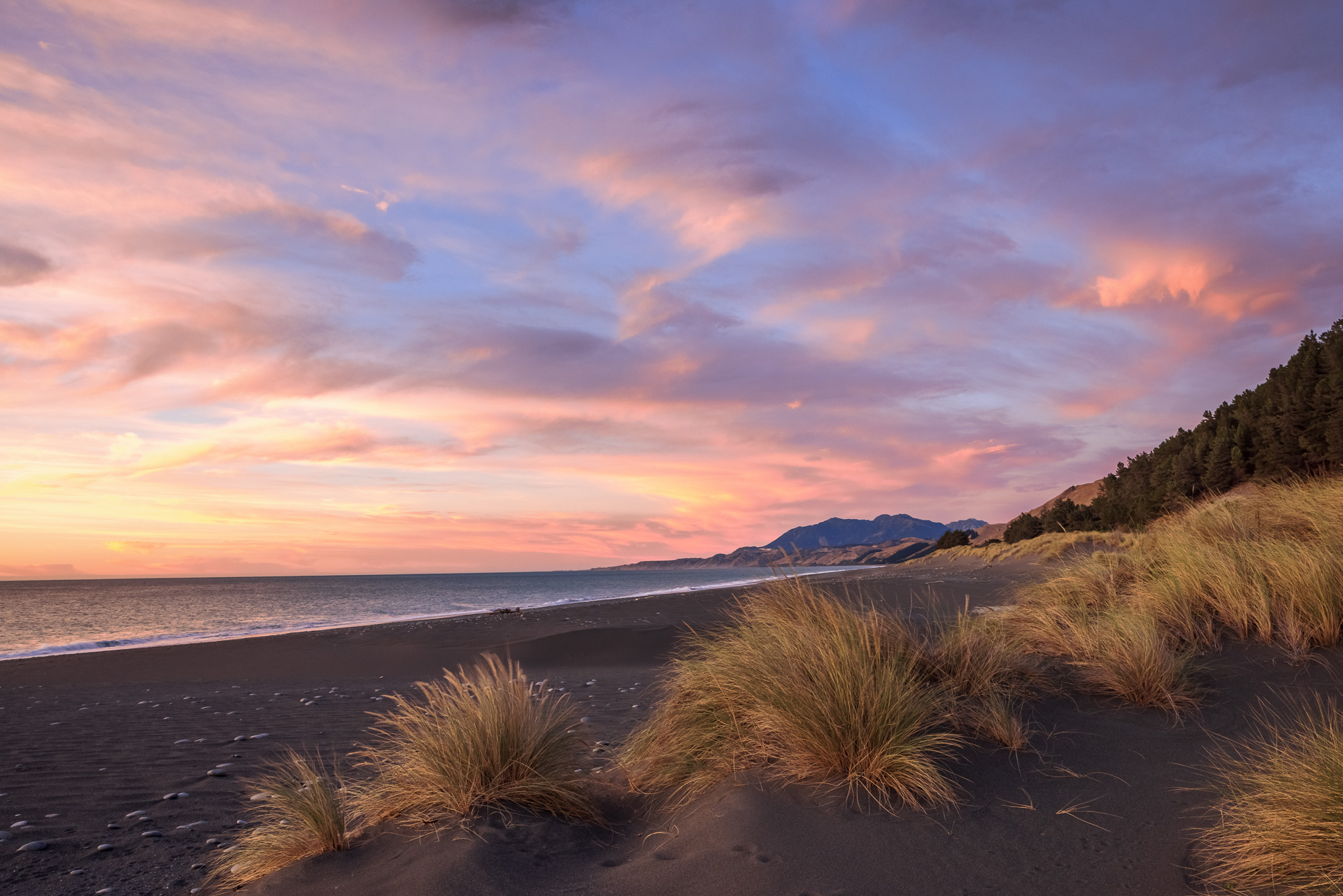
I am getting my daily aerobics jumping down from the van and opening and closing the various farm gates every km or so. We round a corner and Chris lets out a stream of expletives. He has caught sight of the iconic lighthouse and it is completely covered in scaffolding. Photography plans foiled, we cut short our stay and head back out onto the road heading south towards Kaikoura. You can freedom camp all along this coastline and we find a lovely spot just off the road parked on the sand dunes on a vast beach, with the coastline disappearing far into the distance.


Having gained two days before our ferry crossing due to the unphotogenic lighthouse, we research alternative plans. We decide to head to Hanmer Springs and then drive the old Acheron road to Blenheim through Molesworth Station. This also gives us time for an afternoon of cellar doors on our way back through, hello Marlborough vineyards!
Kaikoura
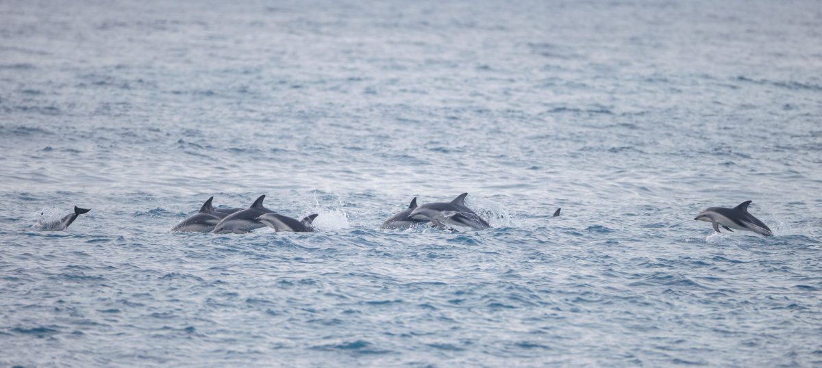
This length of coastline has been reshaped by the earthquake in 2016, with the coastal shelf rising out of the sea and big landslides on the hills wiping out parts of the coastline, including large sections of the road. It is a beautifully calm day and as we drive the repaired coast road towards Kaikoura we spot a huge pod of 50+ dusky dolphins, somersaulting out of the water 100m off the beach, enjoying some serious aqua acrobatics as they travel slowly along the coast.
 Dusky Dolphins, Okiwi Bay
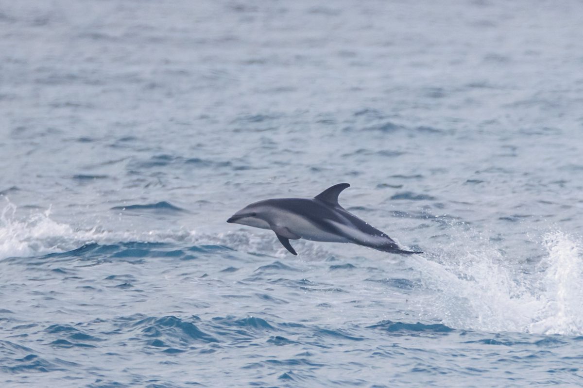
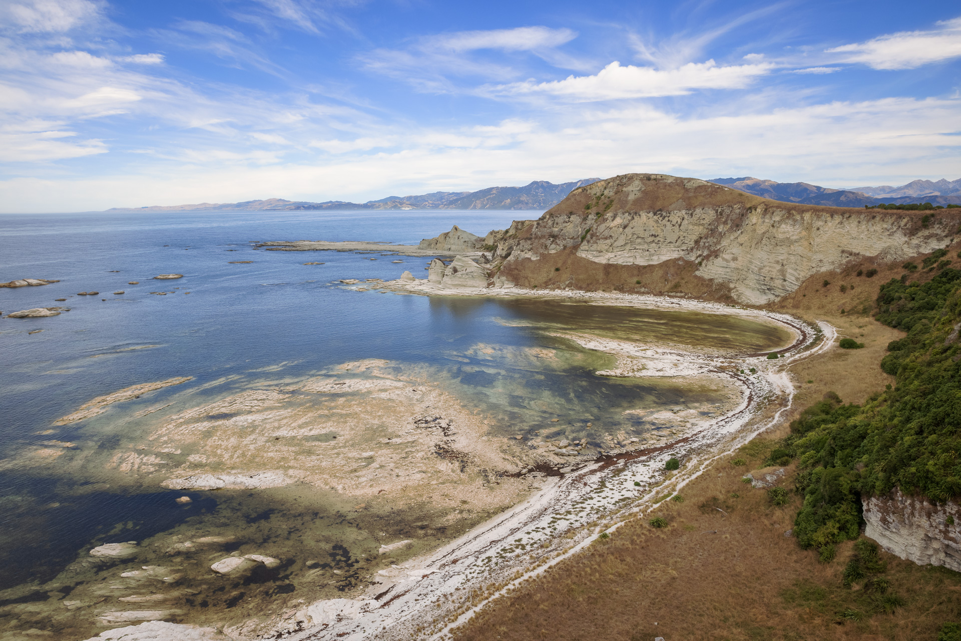
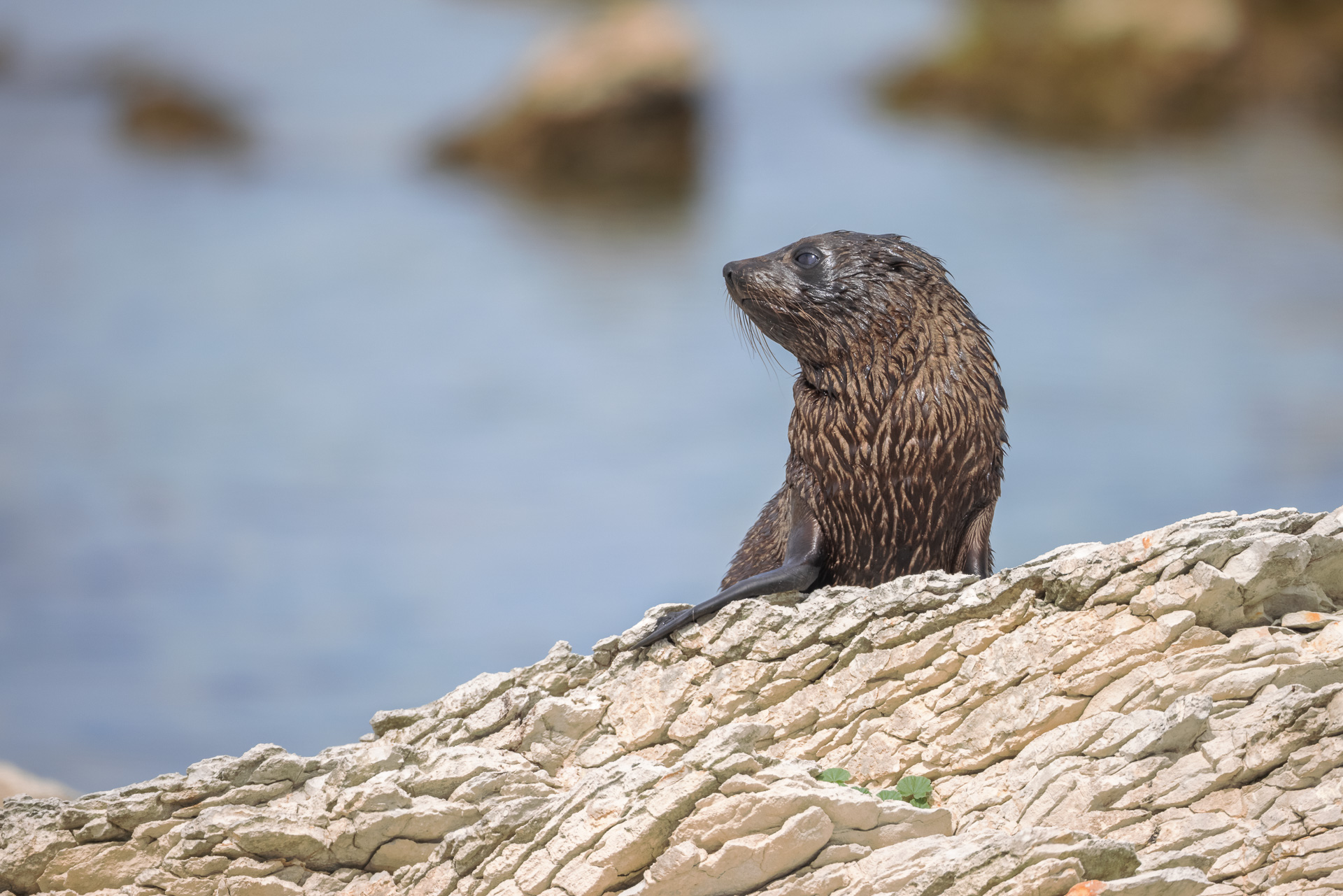
We drive right out to the Kaikoura Peninsula to walk the coastal loop path on the end of the peninsula. The peninsula and shoreline here were raised over a metre by the magnitude 7.8 Kaikoura earthquake in 2016. Apparently immediately after the quake you could walk right out and pick up crayfish off the rocks that had been lifted up out of the sea. We start the loop along the coast, passing along white layered rocks with beautiful blue inlets. The rocks are dotted with fur seals, pups playing in the rockpools under mothers’ careful watch. The return loop climbs up to the top of the limestone cliffs, with a stunning view down the coast with the dark mountains and the bright coastal shelf below.


Hanmer Springs
Our new plan takes us to Hanmer Springs, a spa resort town in the mountains with lots of great walks through the forests with waterfalls and even a sculpture trail. After a hot afternoon drive from Kaikoura to Hanmer Springs, we camp for the night at the council-run free camping area and look longingly at the river which alas is no more than knee-deep. A few intrepid day visitors are however hanging out sitting waist deep in the cool water.
The next morning we hike up to Dog Stream Falls, reached after a hot 45mins uphill through the bush. I don’t hesitate to strip down to my bikini and enjoy an icy blast under the 41m falls, powerful enough to give me a proper ice cream headache. Back down by the village near the car park, there is great little (20min) loop track that goes through the forest and is dotted with sculptures carved from a giant redwood that was grown here.


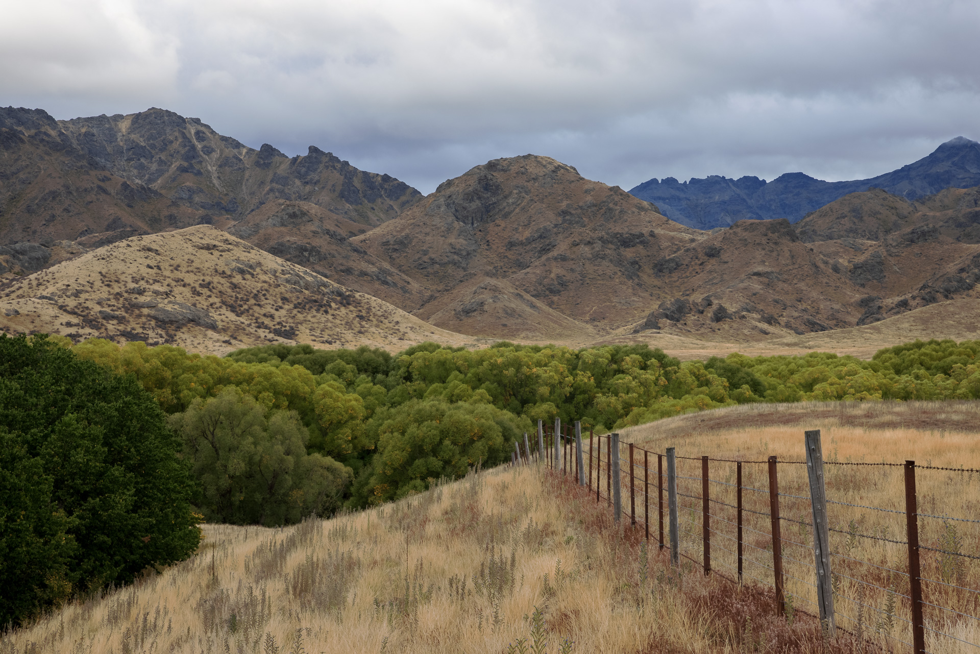
Acheron Road and Molesworth Station
The old muster route from Acheron Road is connected to Hanmer Springs via Hoopies Pass; the original stock road that google maps will try and send the unsuspecting driver on. After careful research, I discovered it is now 4WD only and is mainly used for cattle. The advisable route if you are not looking for 4WD thrills is via Jacks Pass, still a fairly steep winding gravel road that heads up into the Hanmer ski area. It is a slow drive up to the pass where it levels and joins the bumpy and potholed gravel Acheron Road. We had a chuckle driving past a 100km speed limit sign, whilst cruising along at all of 10km/h.
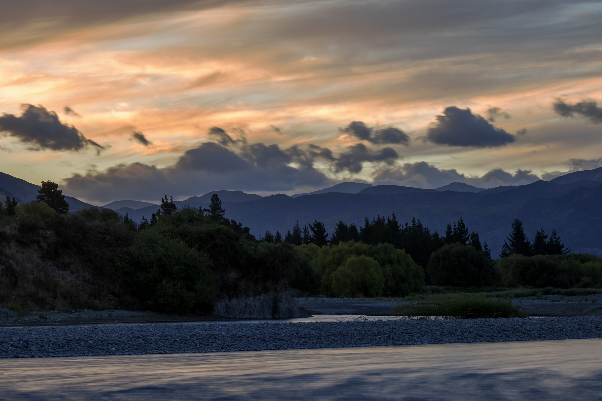
The valley is vast, with no animals in sight and no humans apart from the massive line of electricity pylons running through the middle as far as the eye can see. We learn from one of the DoC storyboards along the route that these cables through Molesworth were built in the 1950s and transmit hydroelectricity from the big southern dams northward to Marlborough and then across the Cook Strait to the North Island.
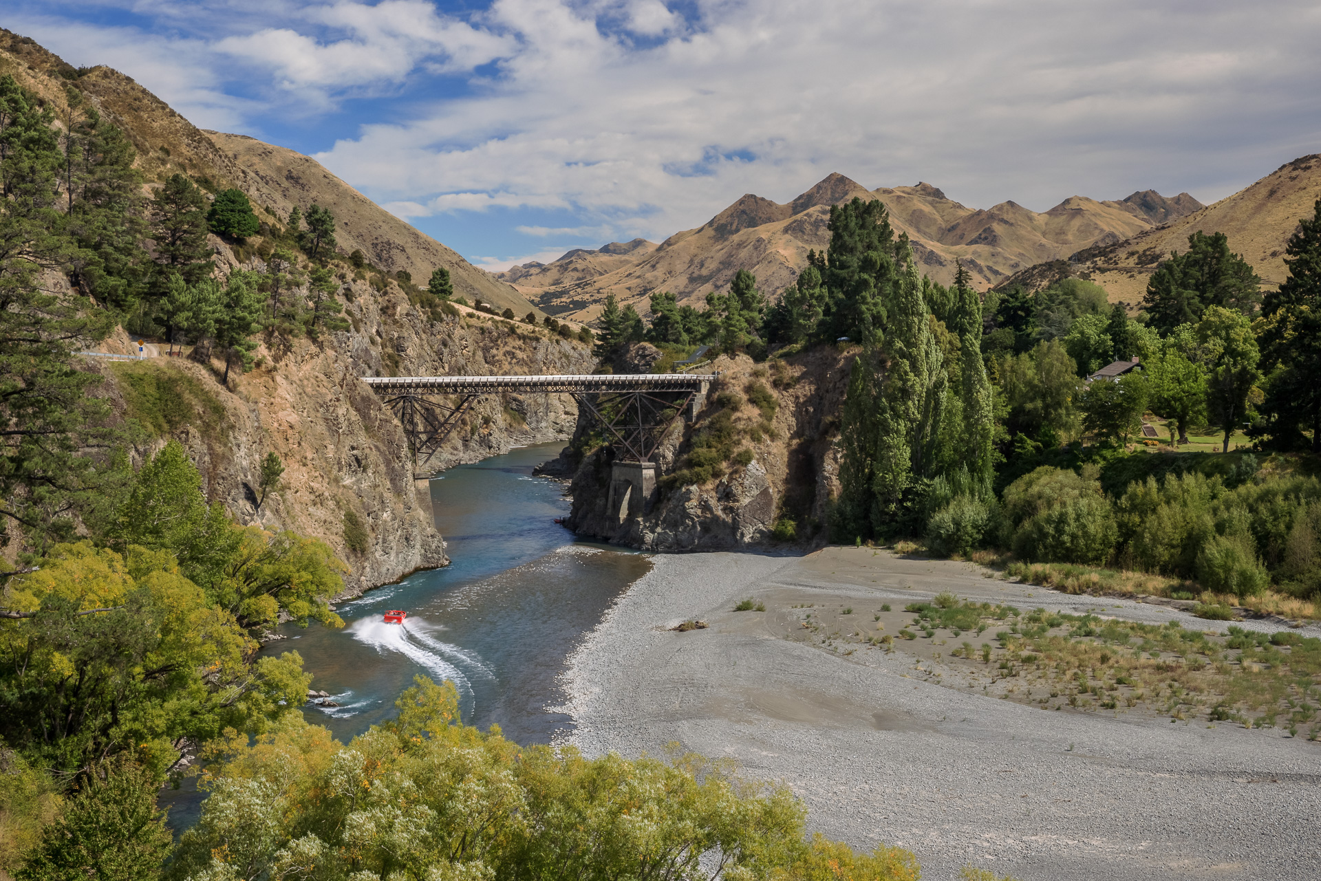
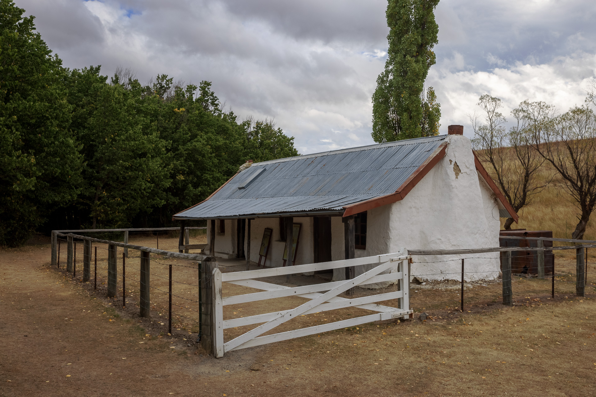
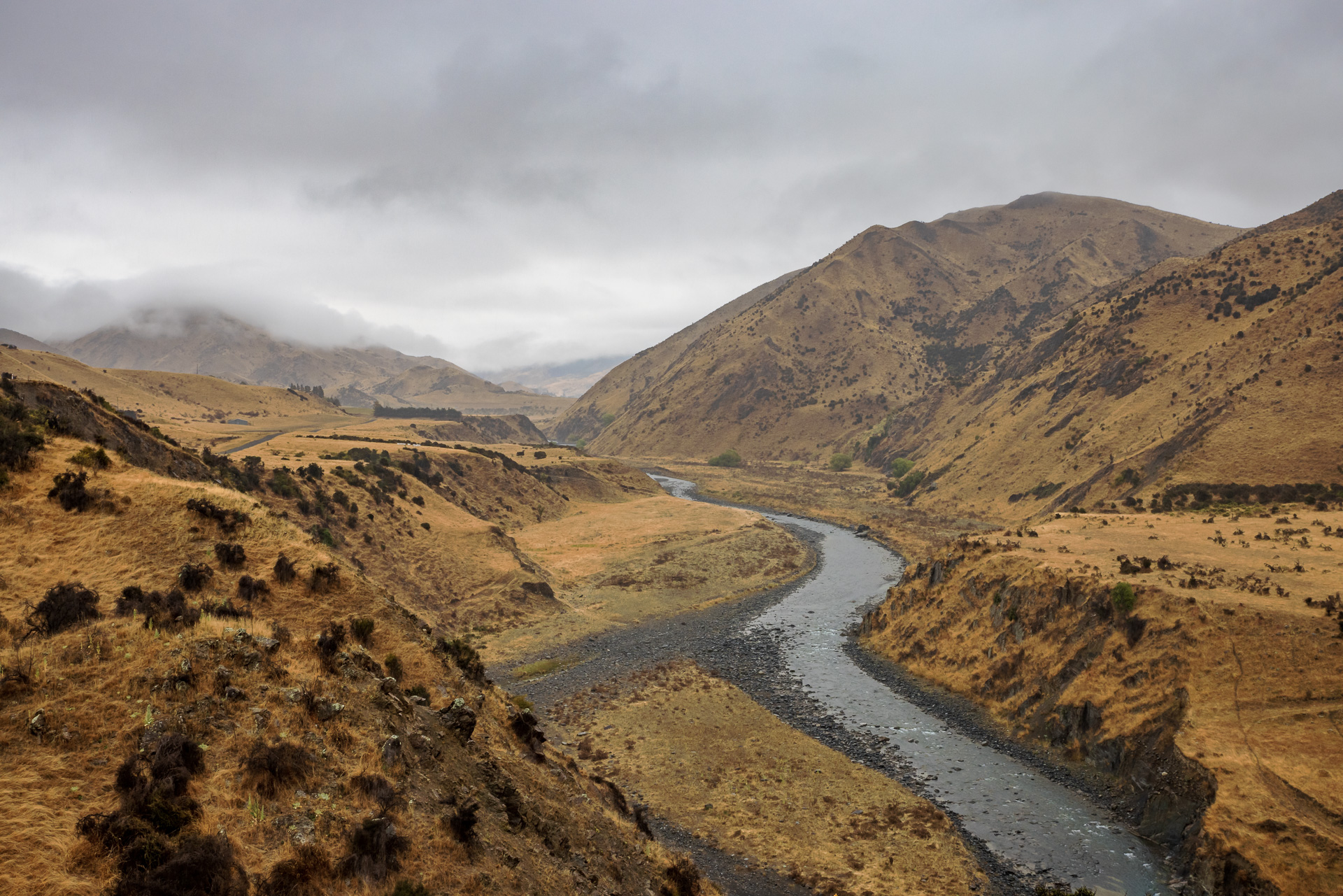
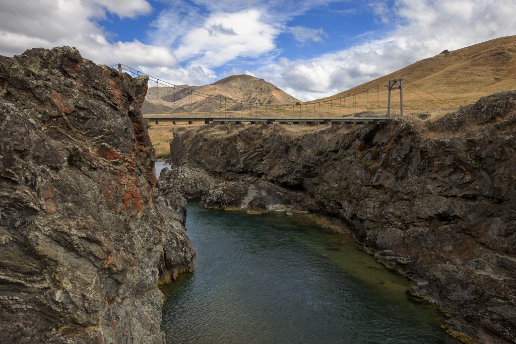
After 1hr 30mins we reach the junction of the Clarence and Acheron rivers and the Acheron accommodation house (1863); an original old cob house built to accommodate stockdrivers along the route. The river is now carving a deep gorge through the valley and the road passes the engineering students stock bridge. Designed and built by a class of university students given the brief in 1944 to build a bridge that would enable an annual muster of 15,000 sheep to cross the Acheron River, it replaced the previous bridge that had been washed away and had only been one sheep wide, typically taking a lengthy two or more days to get the sheep muster across it.
Further upstream we meet the confluence of the Acheron and the Severn rivers on a big wide-open area, the tawny grass on the surrounding mountains is streaked with the granite grey scars of landslides. We continue along the bumpy gravel road zig-zagging across the rivers on very rickety narrow bridges, you certainly would not want to be driving too wide a vehicle on this road. The road climbs up and over Wards Pass, then winds over the next pass and into Molesworth where we reach the DoC campsite and original cob cottage. The cob cottage is full of fascinating history boards describing its past as well as giving us an idea of the hard life of the musterer. It is also like reading a Wild West story, as the original operator of Molesworth had a turbulent history and ended up being jailed for ‘conspiring to lose a carpetbag of money he was transporting for his client on the way back from auctioning his cattle’.


The next morning, we leave Molesworth and join the Awatere Valley Road, towards the main road at Seddon (99km). The landscape keeps changing as the rocks in the river gorge darken adding huge contrast against the golden grassy folds on the surrounding hills.
The road climbs up and into the clouds to cross Upcot Saddle. It is carved into the side of the mountain and single lane, albeit wide enough for passing in places. As it nears Upcot we start seeing the big fluffy merino sheep of the local farms. The road is more and more sealed in places and last 40km follow the river on mainly sealed road.
After 2hr30 we arrive at Mount Riley, our first cellar door at 11am sharp and are greeted by the winemaker himself as the normal sales team are on a break. We find time for two more cellar doors and a delicious lunch before it’s time to head to Picton for the ferry with a garage full of Marlborough wines to take back to the North Island.