We leave the south coast at Invercargill and heading to Te Anau, the gateway to Fiordland National Park. We plan to spend a couple of days exploring the scenic 240km road to Milford Sound, which follows the spectacular glacial valley, providing plenty of mountains to hike and admire, and waterfalls to discover.
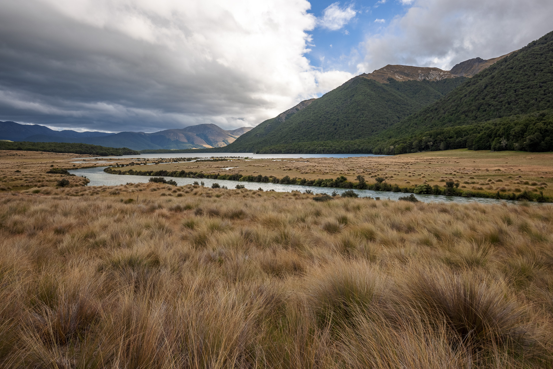
Mavora Lakes
We took a slight diversion on the way to spend the night at a DoC (Department of Conservation) camping area at the Mavora Lakes rather than spend the night in Te Anau. There are camping spaces all along the lakeside with fire pits and piles of chopped wood conveniently piled next to them. We parked under some trees on the edge of the North Mavora Lake near a swing bridge that is the start of some of the hikes.
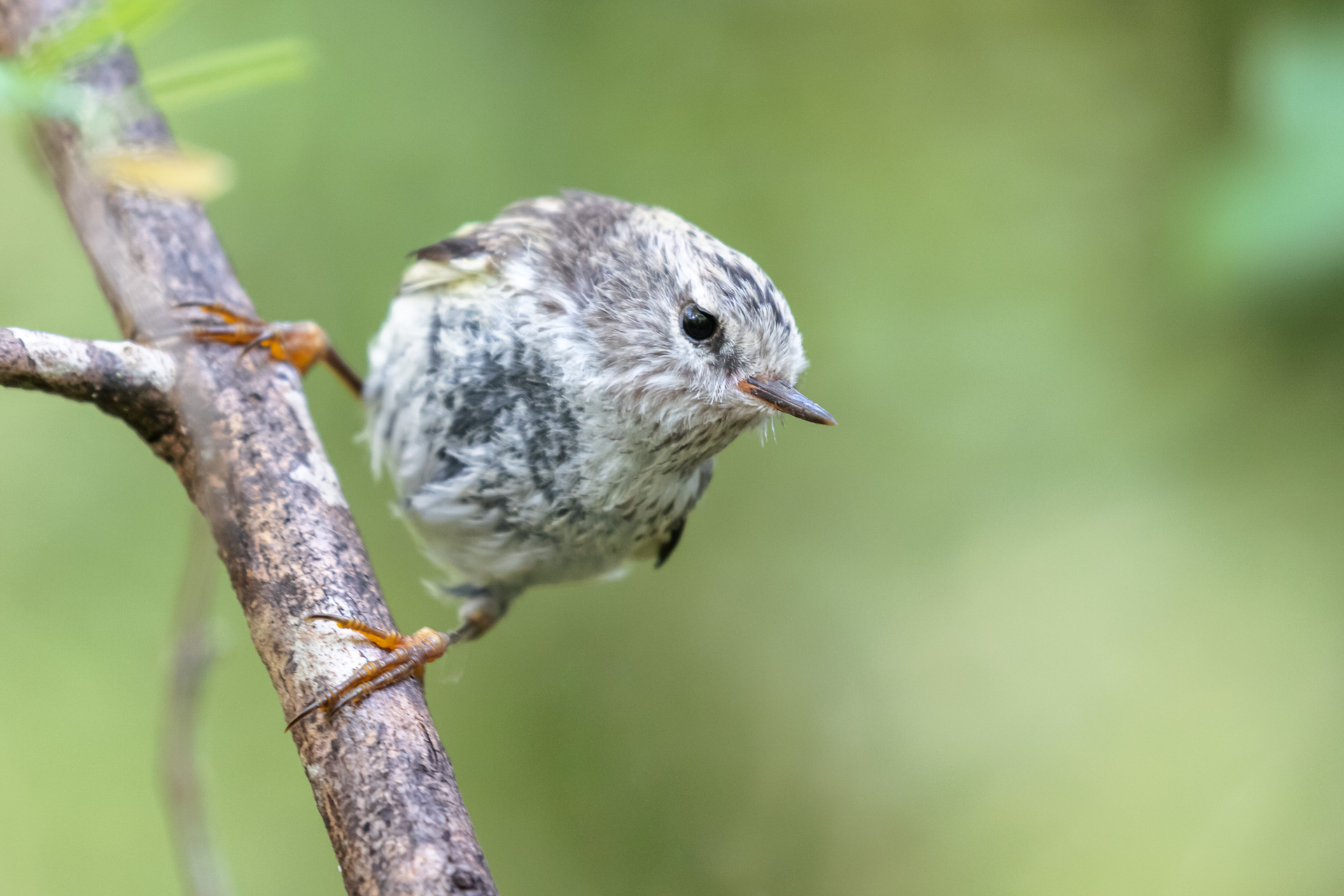
That afternoon we walked the 5km circular loop around the South Lake which takes you through lovely old beech forest teeming with social native birds. We spotted tomtits, South Island robins, a pair of long-tailed cuckoo high up in the trees, and lots of teeny tiny little riflemen, a type of wren endemic to New Zealand.
We have a great mobile app called Merlin that helps you identify birds you have seen with pictures, maps where they can be found and recordings of bird song. I was going through some of the bird songs trying to figure out a particular one we were hearing and played the rifleman call. Suddenly there was a lot of movement in the tree nearest me, and we spotted five tiny little riflemen on the branches coming to check out who was making the call. It works every time, if you hear their call near you, play the recording and they will come and find you. We have no idea what the song is saying, but it draws them in!


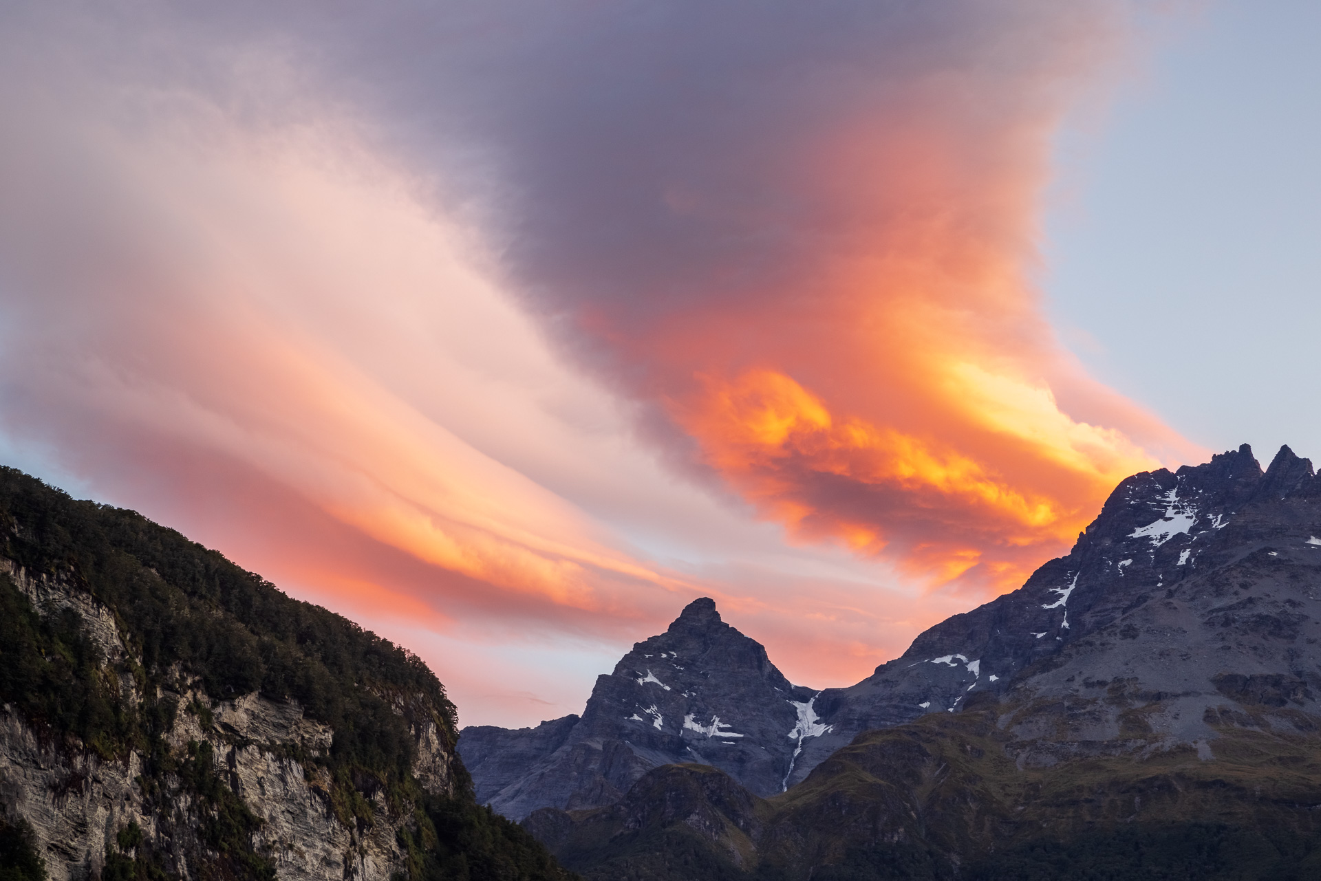
Fiordland National Park and the Road to Milford Sound
The next morning we drive through Te Anau with a quick stop at the DoC office to check their up-to-date weather forecast. Milford is known for being one of the rainiest places on earth, and when it rains it pours, bad for hikes but great for the multitude of waterfalls. The road from Te Anau follows the aquamarine Eglinton River all the way to Milford Sound. Once you pass the Te Anau Downs the rolling farmland turns to wild meadows with steep forested mountains rising from either side of the valley floor.


There are six DoC campsites along the road, we settled on Cascade Creek, the last one before Milford Sound and the closest to most of the hikes and sites of interest. Mountain views, a river running on one side of the campsite, and an enticing old beech forest on the other. With only a handful of other campers, this is Fiordland camping at its best.
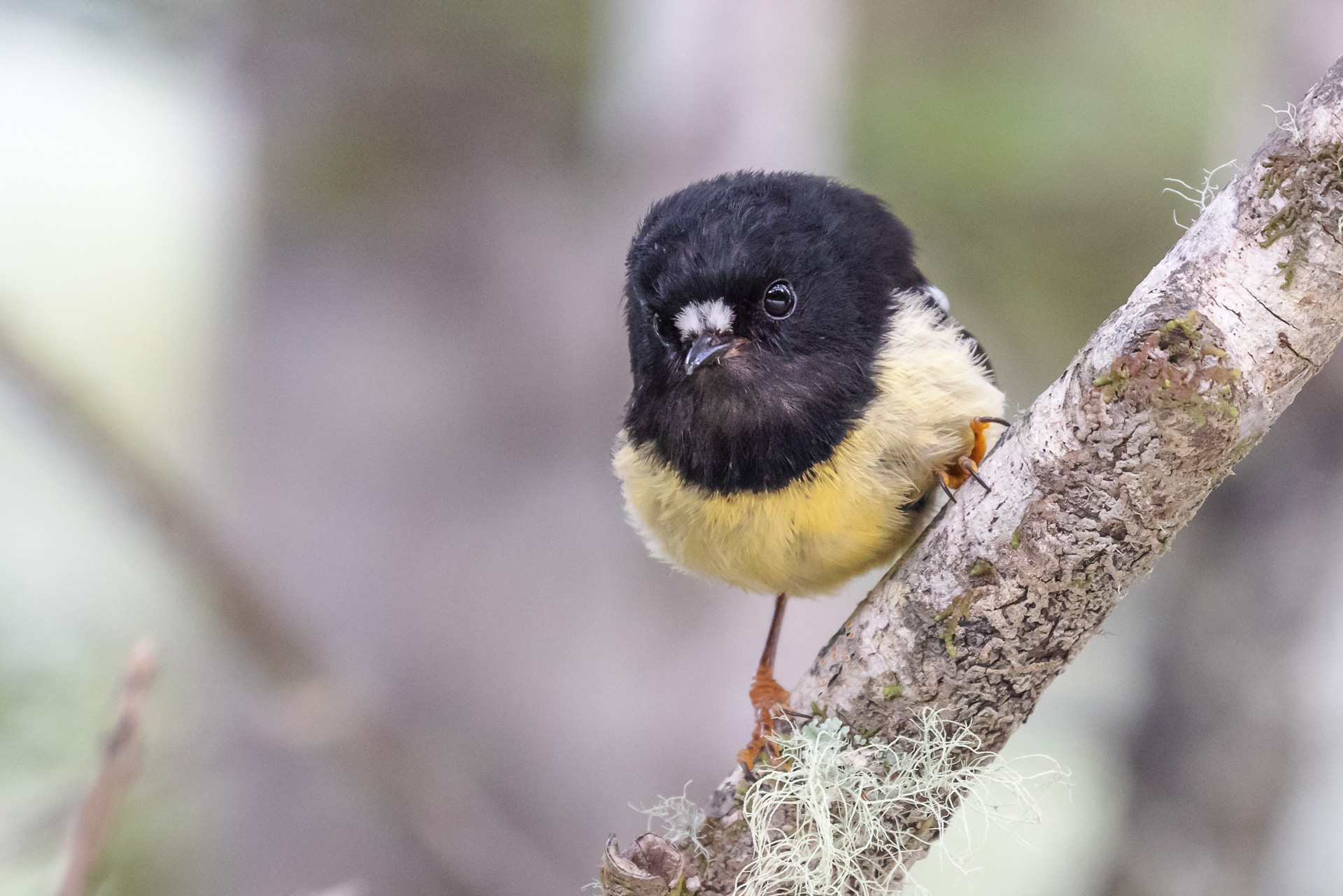
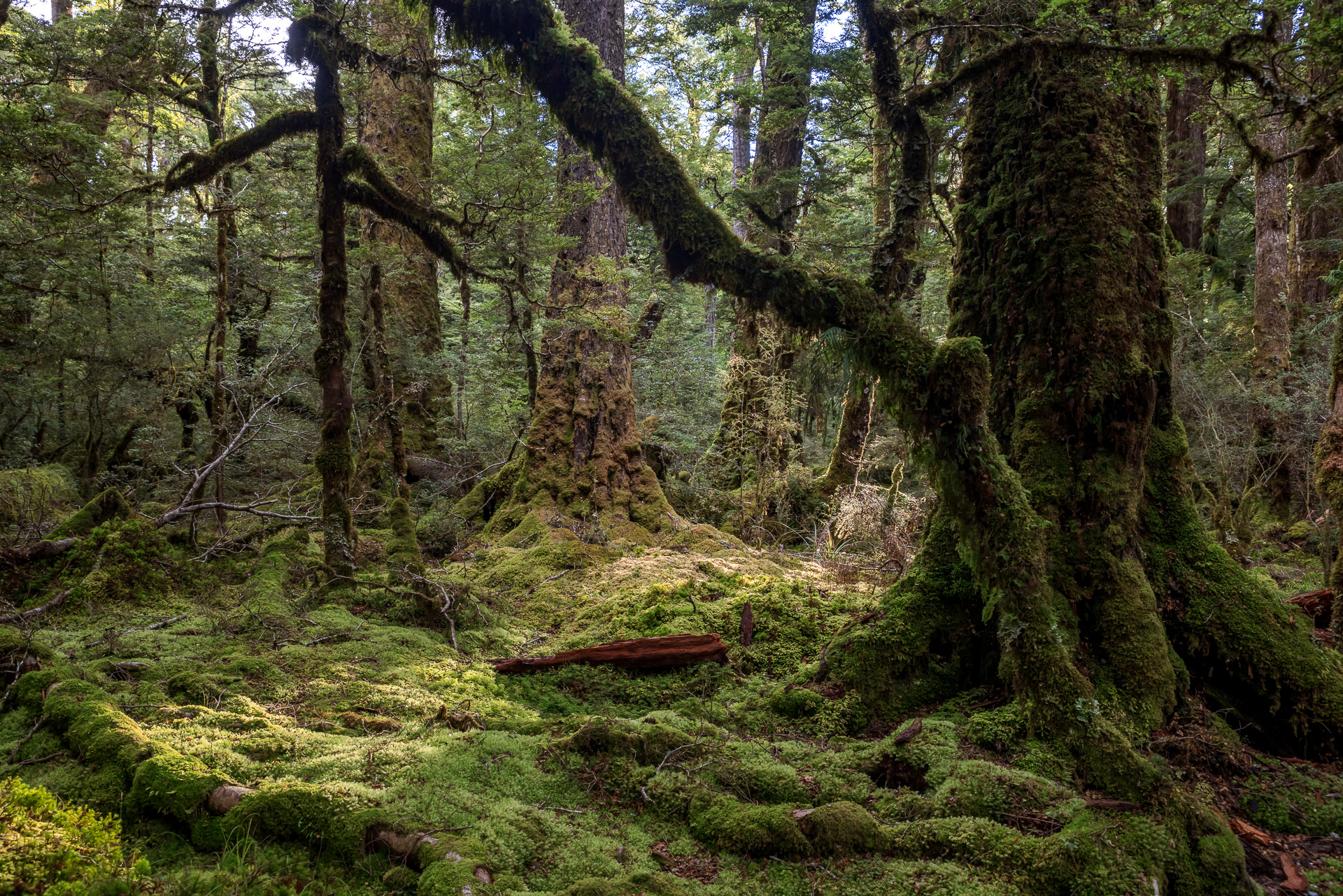
We wander into the beech forest in the early evening to find the Lake Gunn Nature Walk. It is like walking onto a fantasy film set. With the low sun streaming through the beech trees and lighting up the bright green mosses and curling ferns that carpet the forest floor, we are half-expecting a hobbit to appear at any moment. Yes, we are part way through watching a certain set of Tolkien films and are frequently finding ourselves in Middle Earth. We did not spot any hobbits, but instead plenty of South Island robins who would suddenly make themselves known nearby. One particularly inquisitive robin hopped around my feet and had a few hopeful tugs on my shiny bootlace.


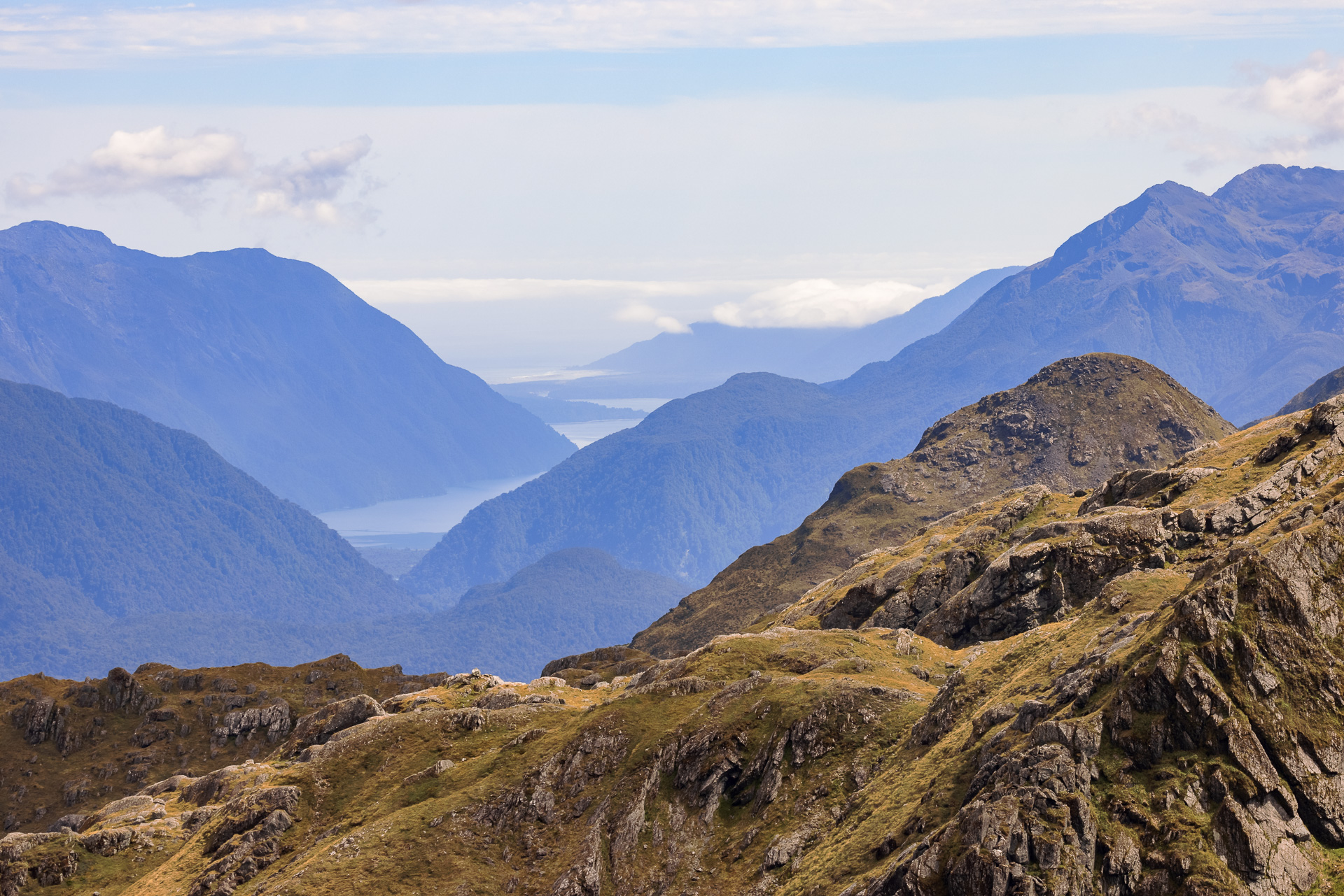
Key Summit Peak
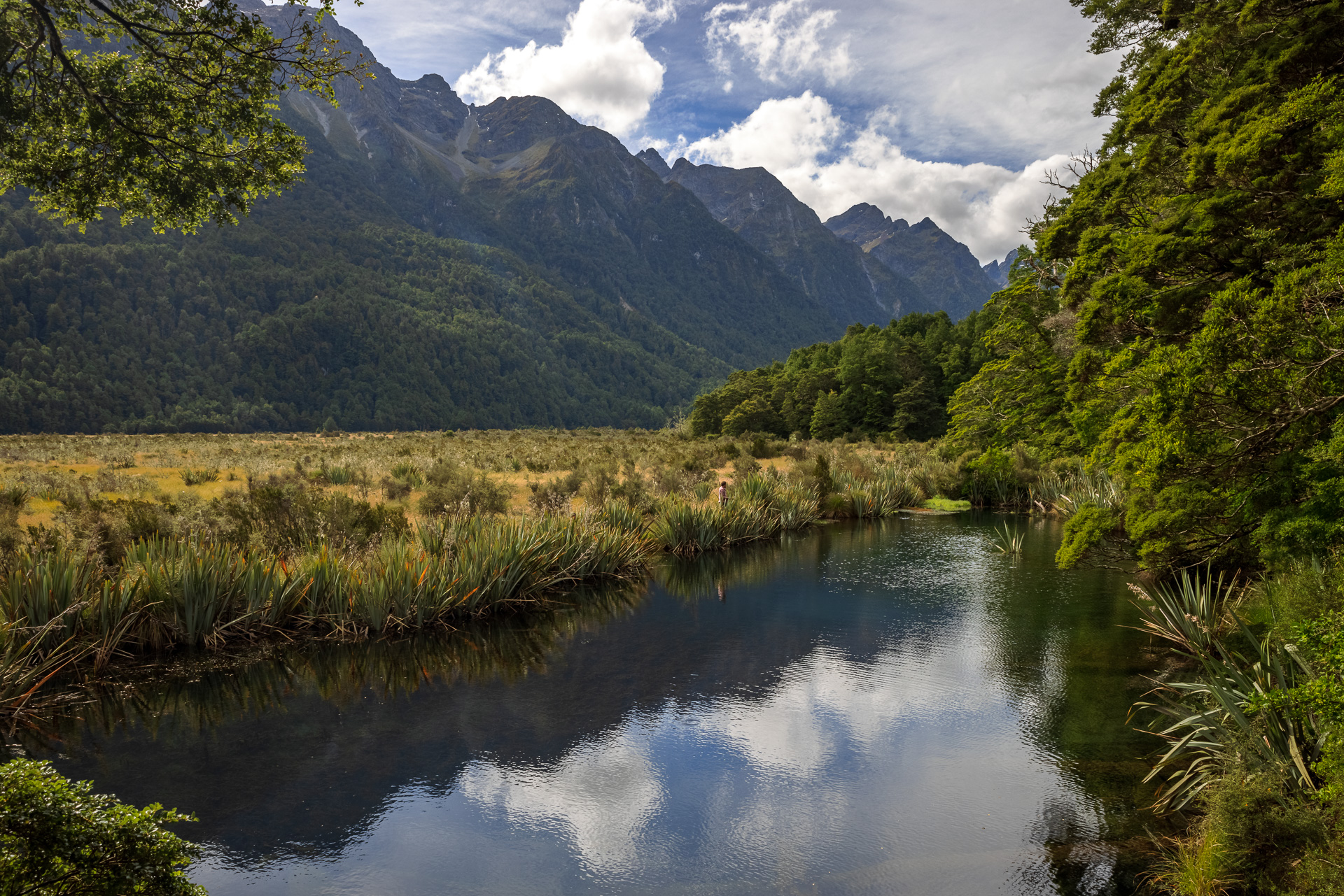
After a quiet day spent sheltering from a day of heavy rain, doing little side trips, and generally watching the weather go by, we wake up to blue skies ready for our next big hike up to Key Summit. Key Summit, named as it is ‘key’ to three watersheds for the raindrops that fall there depending on their journey down the mountain. North and west will take them to the Tasman Sea, east to the Pacific Ocean, and south to the Southern Ocean. The trail is a long gentle ascent through podocarp forest climbing 500m over 5km. This hike is the start of the popular Routeburn Track, one of New Zealand’s famed great walks. We set off at 7am in the cool of the morning, hoping to avoid the crowds.
You know when you are the first up a forest trail that day when you constantly feel silky spider webs stretch and then break across your face. One of the advantages of Chris being a faster walker than me is that he normally breaks the trail of spider webs. If I ever overtake him, usually because he has stopped to get his camera out, I immediately start feeling the sticky threads across my face and catching in my hair. Time to slow my pace down and let him pass again!
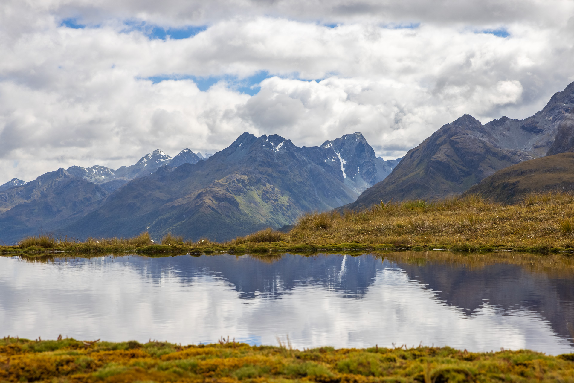
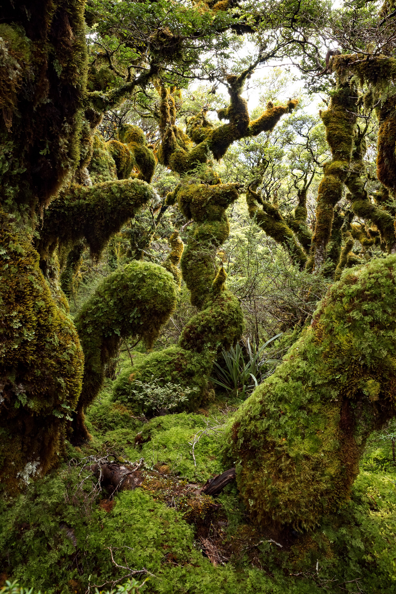
After about an hour of gentle ascent, we emerge from the forest onto the high alpine wetland at the mountain top. A wide peaty ridgeline covered with spongy green mosses, lichens, and gorgeous tiny white flowers. Deep brown tarns are dotted throughout reflecting the snowy peaks of the surrounding mountains. We follow an unmarked trail that climbs along the ridge and leads us into a mystical grove of goblin trees. Thick multi-hued mosses have covered the trees and are almost dripping from the branches. It is only at the very top of the trees that we can see the bark and leaves of the tree poking through. Each tree seems to have a whole ecosystem living on it. After ducking and diving and weaving through these crazy trees, the path leads us back out into the sunlight on the ridge, with glorious views down the Greenstone Valley.


We head back the way we came, downhill all the way, passing scores of hikers looking shiny and clean with massive backpacks on their first day of the Routeburn Track.
Falls Creek
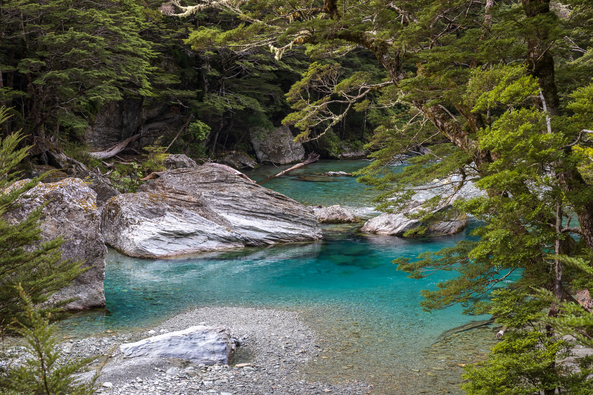
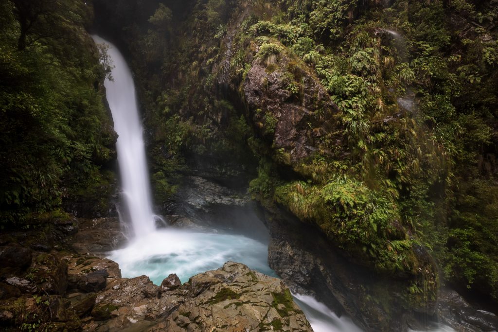
Our next point of call is Falls Creek just down the road. The road passes a small waterfall, but according to our handy guidebook ‘just a short scramble’ up a path we will find another spectacular waterfall. It is indeed a scramble, we are pretty much climbing up the tree roots on the mountainside and need at least one free hand, sometimes two. The increasing roar of the waterfall encourages our tired legs on. We feel the cooling mist of the waterfall before we see the white water gushing from a saddle in the mountain above, down into a temptingly clear blue plunge pool. Green mosses and ferns on the limestone rockface are glistening with the spray of the waterfall. Totally deserving of the short scramble/climb.
The real adventure however starts on the way back down. We are so focused on climbing down tree root by tree root, that we do not notice a split in the trail until we realise that we can only see blue triangles and pink ribbons. There are small signs at the start of all the DoC trails telling you to follow the orange triangles not the blue or pink ones or any other marker, as these are the trapping lines that are steep, overgrown and often precipitous. Too lazy to go back up and find the orange triangles, we commit onwards into the trail we are already following deep into thick bush. The trail gradually becomes less obvious and we soon reach the last faded scrappy looking pink ribbon.
Before we came to NZ, Chris told me repeatedly about the dangers of leaving the trail and getting lost in the bush, and how many idiot tourists do it every year. So obviously I start to panic a little, no matter how much he tries to reassure me that the only way is down and shortly down there we will find the road. Thankfully, NZ has no snakes, poisonous spiders, nettles, or other nasty surprises to watch out for when you bushwhack your way down a mountain. And we do find the road before I get lost or fall off a cliff. I learn a valuable lesson, always keep an eye on the orange triangles!
Fiordland Walkwire
One adventure left for the day is the Fiordland walkwire, a tightrope of a swing bridge that is part of the ominously named Mistake Creek Track. A quick ten minutes from the car park and we are balancing our way across the walkwire with the river rushing by 2m below our feet. A nice little pick me up at the end of a very big day.

We spend the night at Kiosk Creek campsite. A lovely DoC campsite right on a bend in the Eglinton River with a rope swing into a blue pool which I am totally up for trying, once I have recovered some energy.
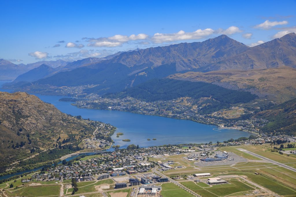
Queenstown
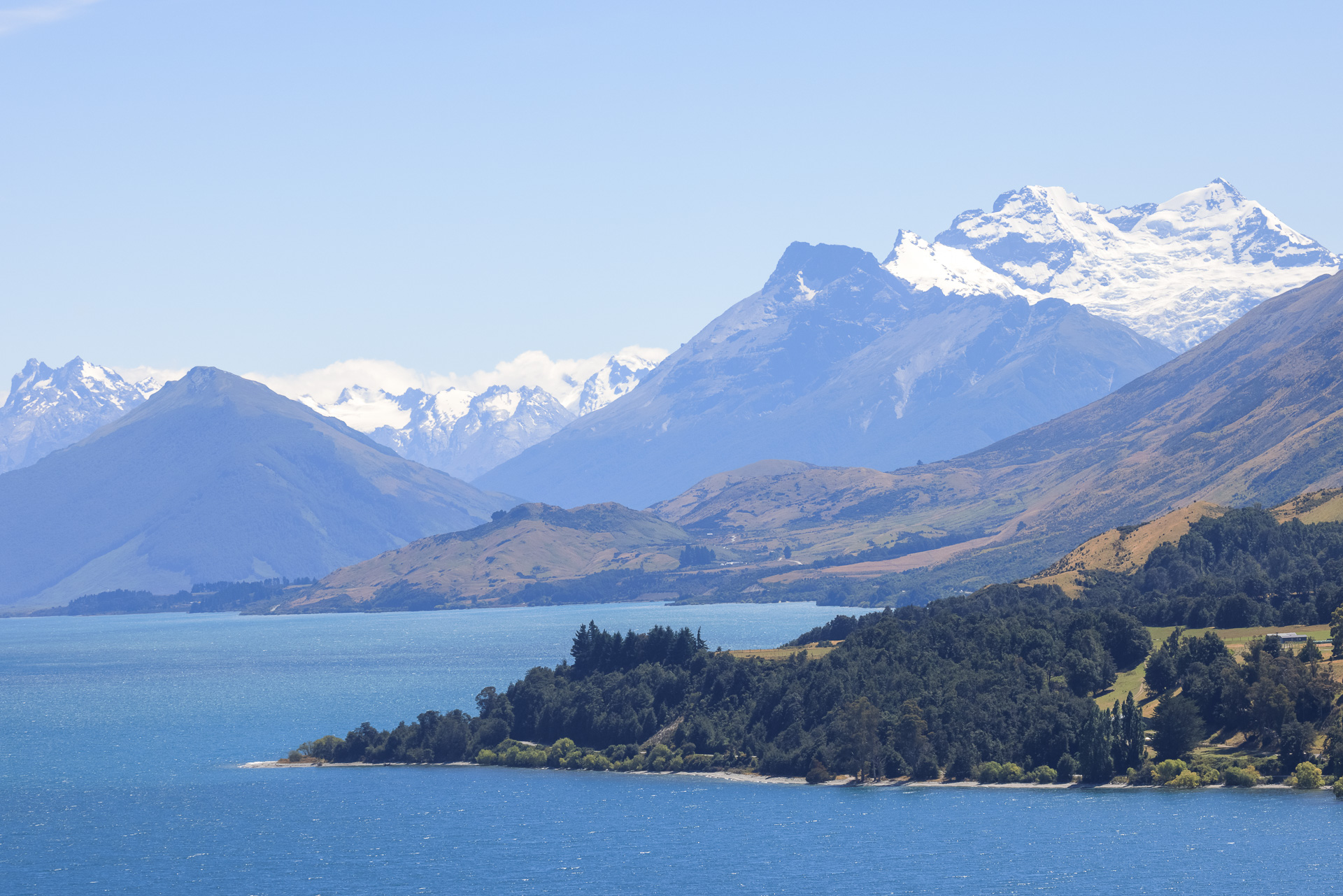
After a fabulous few days along the Eglinton Valley, we head off to Queenstown. The road approaching Queenstown is spectacular. It meets the S-shaped Lake Wakatipu and hugs the side of it for 40km, with glorious views of huge mountains rising from the deep blue water. We spend the weekend with Chris’s cousins Nick and Eva and enjoy a taste of the exhilarating Queenstown lifestyle. Mountain biking on the ski hill behind their house, swimming in the ridiculously blue river just down the road, topped off with a sunset BBQ. I feel like I have found my spiritual home, what a city for year-round outdoor adventures.
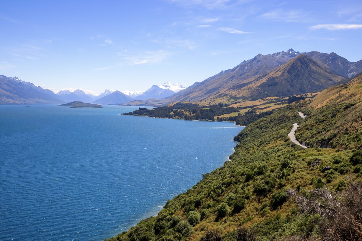
Chinamen’s Bluff
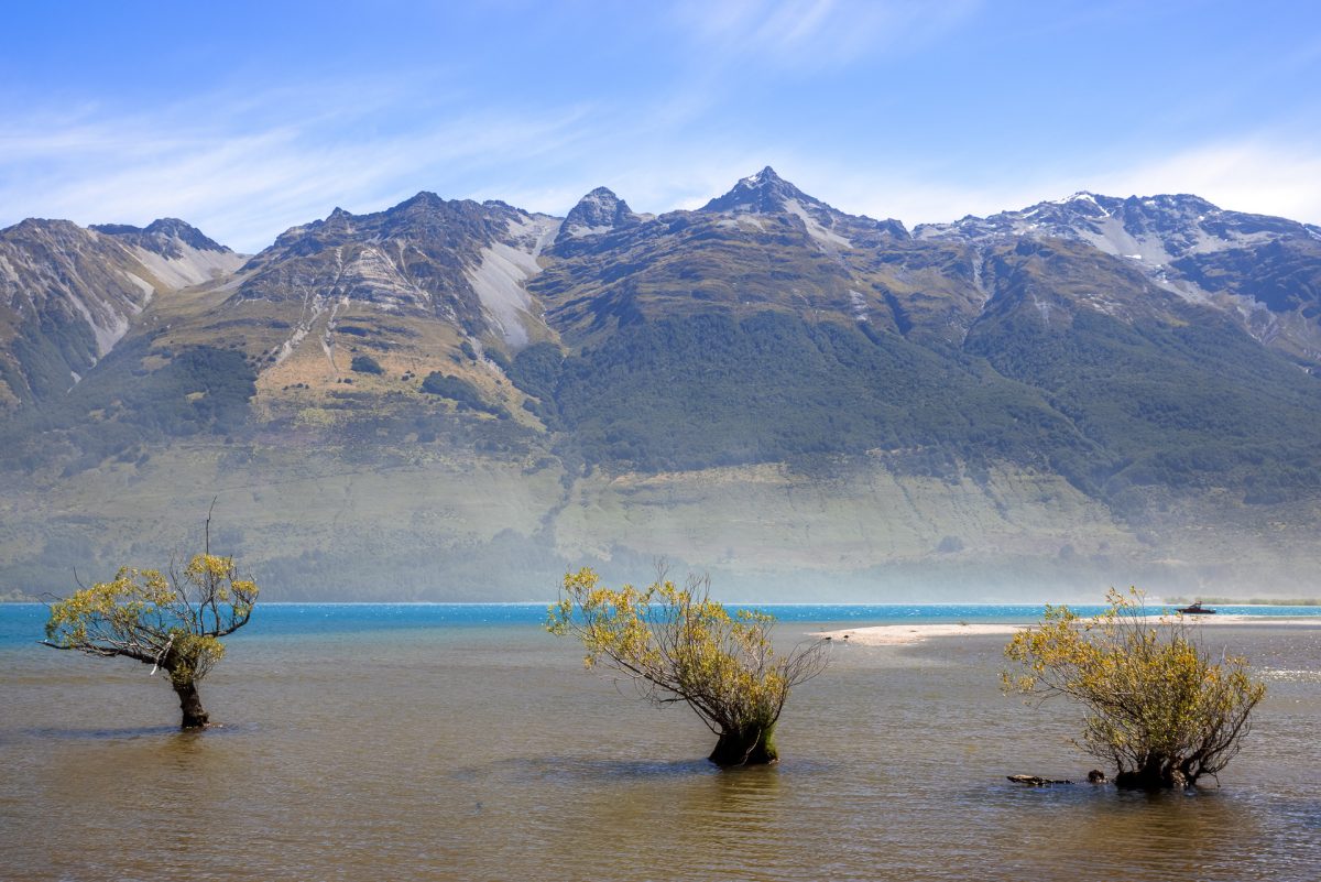
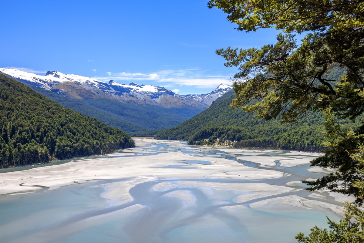
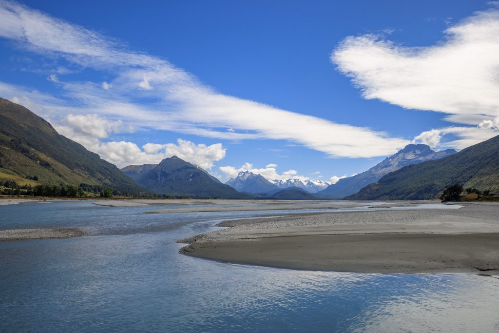
We continue our drive round the scenic lakeside from Queenstown headed to Glenorchy, with multiple stops to admire the breathtaking views. From Glenorchy the road follows the Dart River; a beautiful pale blue alluvial river to an aptly named old cattle ranch and guesthouse called Paradise.

From Paradise we turn onto a 12km gravel road with several fords to cross, nothing too troubling as we have not had any rain for the last few days. We arrive at the end of the road at Chinamen’s Bluff and find a DoC campsite surrounded by lush bush and rugged mountains.
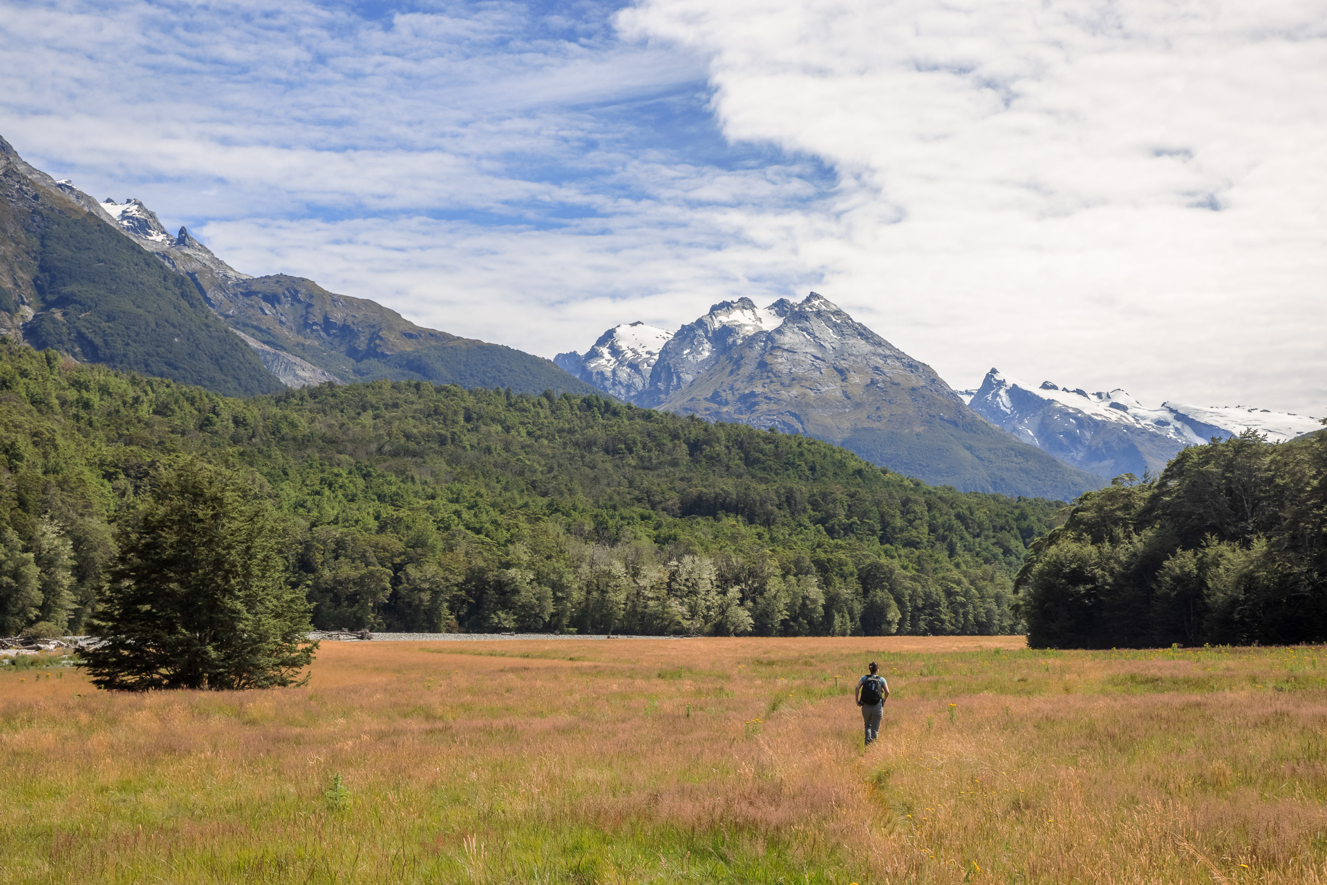
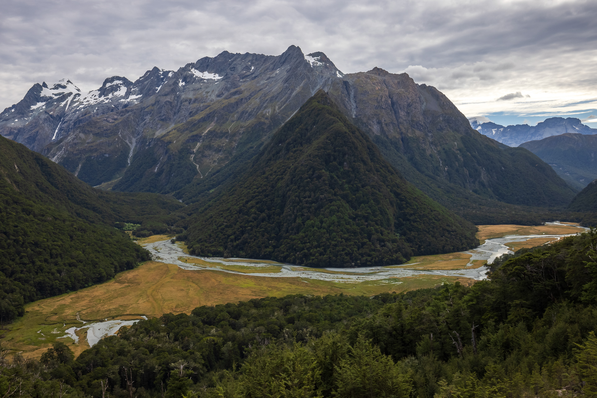
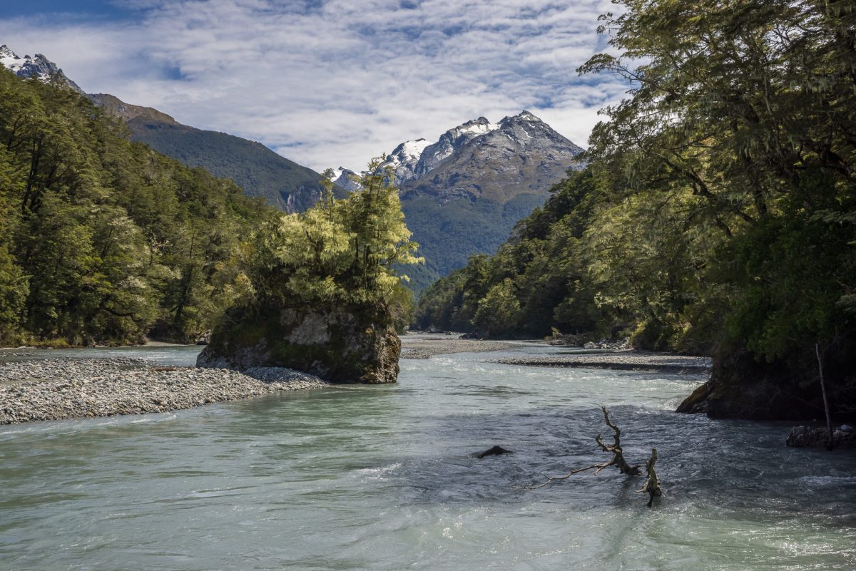
We set off the next morning on the Dart River Trail with a packed lunch and of a mindset to walk as far as we feel like. The trail is part of a 2-day hike that loops back up the Rees River. Our target turnaround point Sandy Bluff a vague 3-5 hours away according to the DoC signboard.
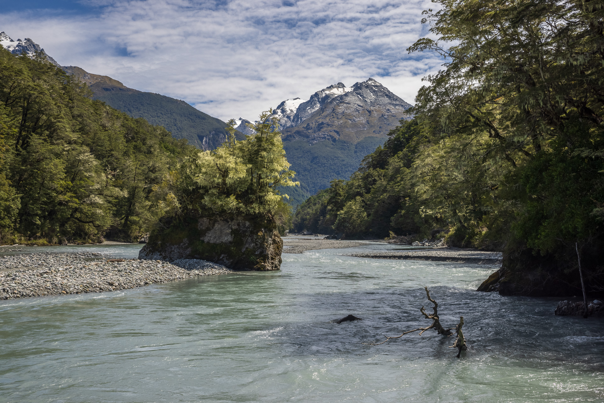
The trail follows the beautiful blue glacial river with the path gently undulating along the forested shoreline. We are constantly catching lovely glimpses of the river through trees to our left, in stark contrast with the steep rockfaces towering above the treetops on our right.
After about 5km the path emerges into the open, with jaw-dropping views of Surveyor’s Flat. A vast landslide on the opposite mountain has taken out all the forest, leaving an avalanche of white boulders streaking down to the water. The sparkling blue river has carved itself a new route through the rubble and rages past the black stumps of dead trees holding on for all their might until the next flood washes them away.
We cross a bridge where the trail dives into the forest and starts to get a bit more challenging. Increasingly muddy underfoot, it goes up and over tree roots and boulders. In some places, the path is almost carved into the sheer overhanging rockfaces, with water trickling through green mosses overhead. We keep going and going until I am hot, exhausted and in need of a lunch stop. Suddenly we catch sight of the bluest of blue pools in the river far down below. As we round the next corner the path opens onto a stunning view of a vast alluvial floodplain stretching out in front of us.

We find a rock bench in the shade of a rocky overhang to enjoy a well-earned lunch break with this breathtaking view. Heading back the way we came, I quickly run into a group of trampers sitting in the middle of the path, eating their lunches, shoes and socks off to air their aching feet. With a cheeky grin I tell them of the lunchtime view they would have had if only they’d continued a few steps further up the path.
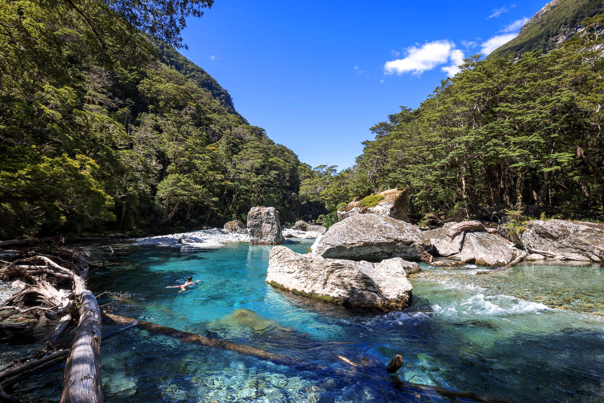
Throughout the return trip I am spurred on by the thought of a cooling dip in the river in an eddy we had spotted earlier about 2km from camp. It is as divine as we had remembered, deliciously cold and refreshing after the hot walk back.
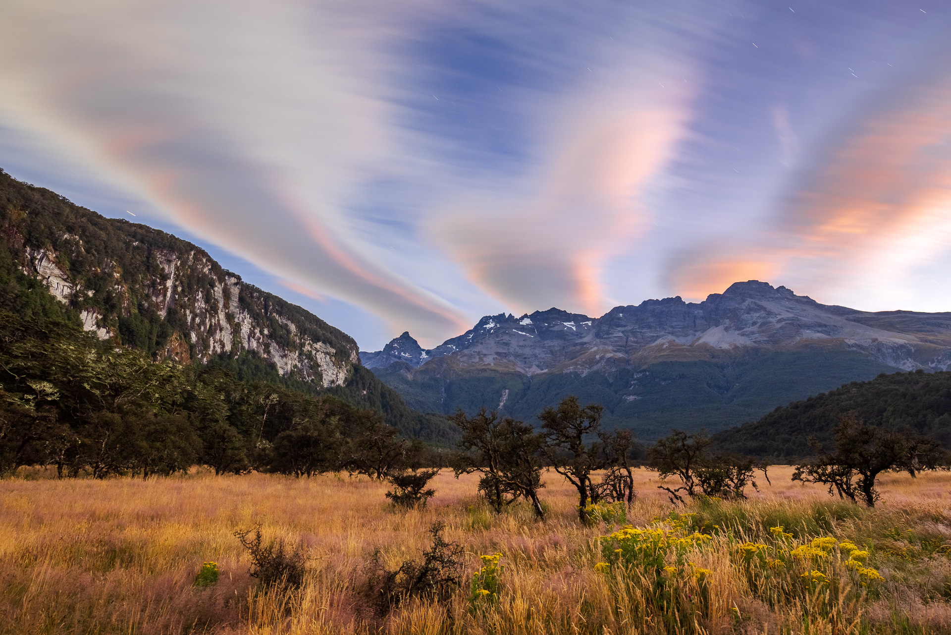
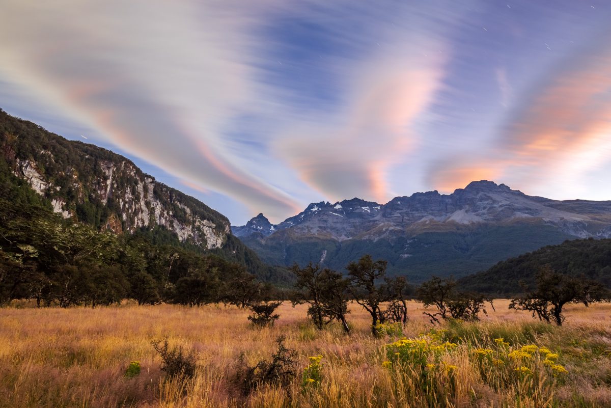
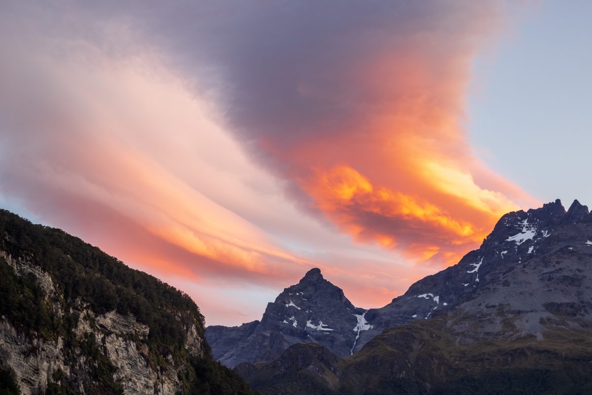
Our sleep that evening was broken with multiple wake up calls to see the mesmerizing night sky, listen to the dawn chorus and finally watch the sunrise in this beautifully remote camping spot.

We spend a lazy day driving round to Lake Sylvan, stopping for a quick snap of Middle Earth’s Isenguard.
The Routeburn Track to Conical Hill
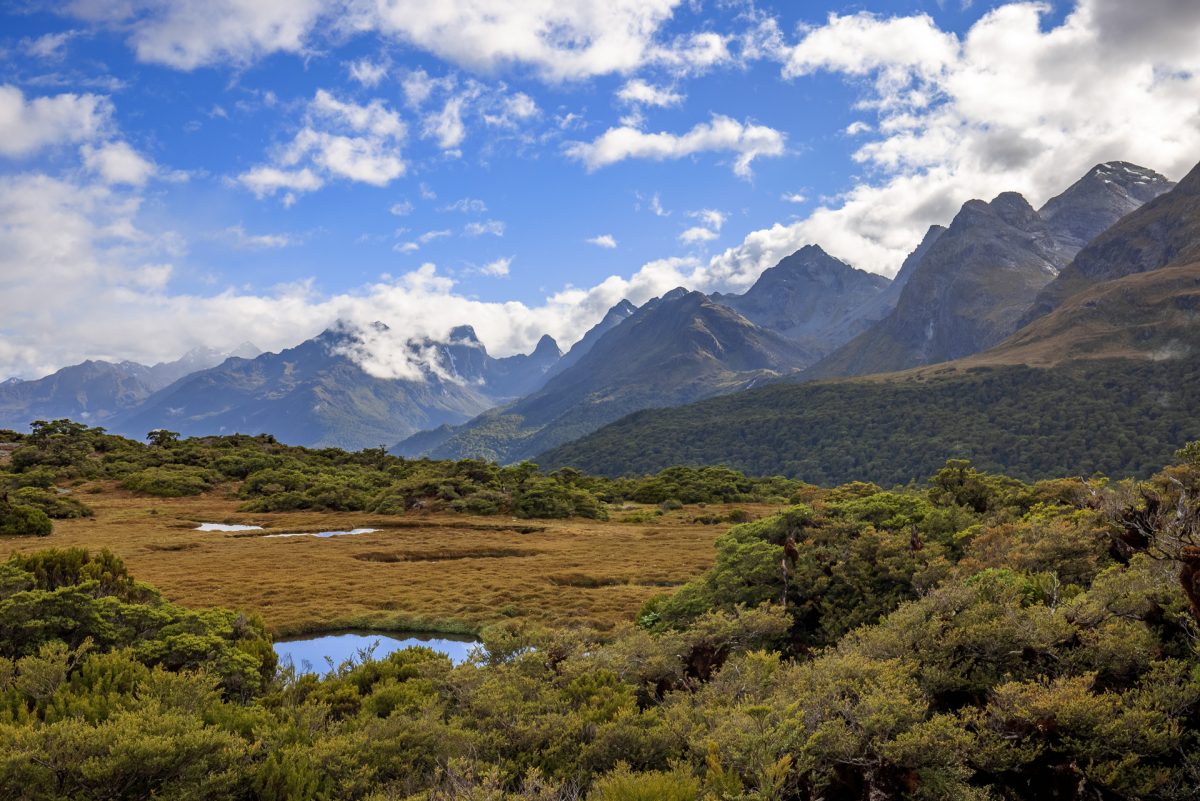
The next morning we are up with the sunrise to hike the other end of the Routeburn Track up to Lake Harris. The first 5km of the path are a gentle climb through forest, following a gorge with sheer cliffs dropping into the turquoise river. The path crosses Routeburn Flats and then gets slightly steeper. At one point it crosses a landslide with a great view of the flats below. We pass a DoC guide here who is heading down the mountain. He is quick to recommend we continue up past Lake Harris to Conical Hill, and so the seed is sown.


Next stop is the Routeburn Falls; one of the DoC huts with bunks for those who are booked on the full multiday great walk. Directly above the hut are a lovely series of waterfalls and plunge pools. Upwards from here the scenery changes. We are above the tree line and the track climbs through rolling tussock meadow with gorgeous big mountain daisies and gurgling mountain streams.
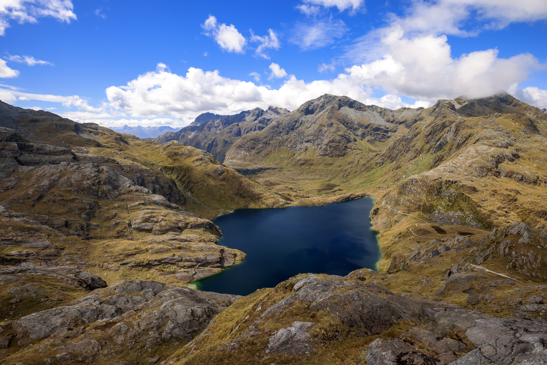
It takes about an hour to reach Lake Harris. After a quick discussion we decide to keep going up to Harris Saddle, just to have a look at what is over the other side. We get to the saddle and see wooden steps climbing up the rock face above it, tempting us to head on up to Conical Hill. Well, we could not get this far and not go all the way to the top. The steps however are slightly misleading as soon as they turn the corner they finish, and we find ourselves scrambling up a steep rocky gully the rest of the way. I reach the top and collapse in a heap to catch my breath before looking around. The 1515m high and somewhat understatedly named Conical Hill is worth the extra push; we can see all the way past the mountains to the surf breaking on a beach over 50km away.


We really feel all 14km of the track underfoot on the way back down. We find a welcome break at Forge Flat, where there is a lovely swimming pool in the refreshingly cool mountain river.