

Our New Zealand road trip starts in Christchurch and heads south through the Southern Alps, winding our way through the mountains towards Dunedin halfway down the east coast of the South Island. Our first part of the trip takes in the amazing blue glacial lakes and rivers of the island.
We picked up our motorhome from Wilderness in Christchurch. A compact Fiat conversion that is perfect for the two of us and our seven-week road trip of the South Island. Whilst in Christchurch we took the opportunity to visit some family. Thank you to Chris’s Aunt Penny for a lovely BBQ evening and the use of her laundry! Thank you also to my cousins John and Judith, for our last night of luxury before we hit the road.
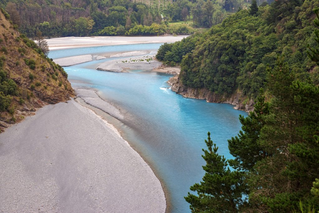
Rakaia Gorge
Our first stop is Rakaia Gorge, there is a lovely 2.5km walk to a lookout over the gorge. The path there is a gentle uphill and the views of the river and the bridge are constantly changing through the breaks in the vegetation.
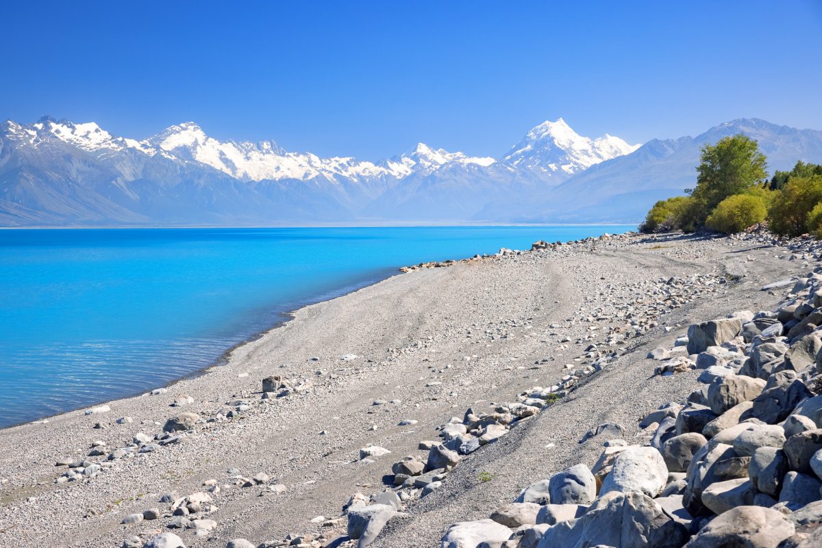
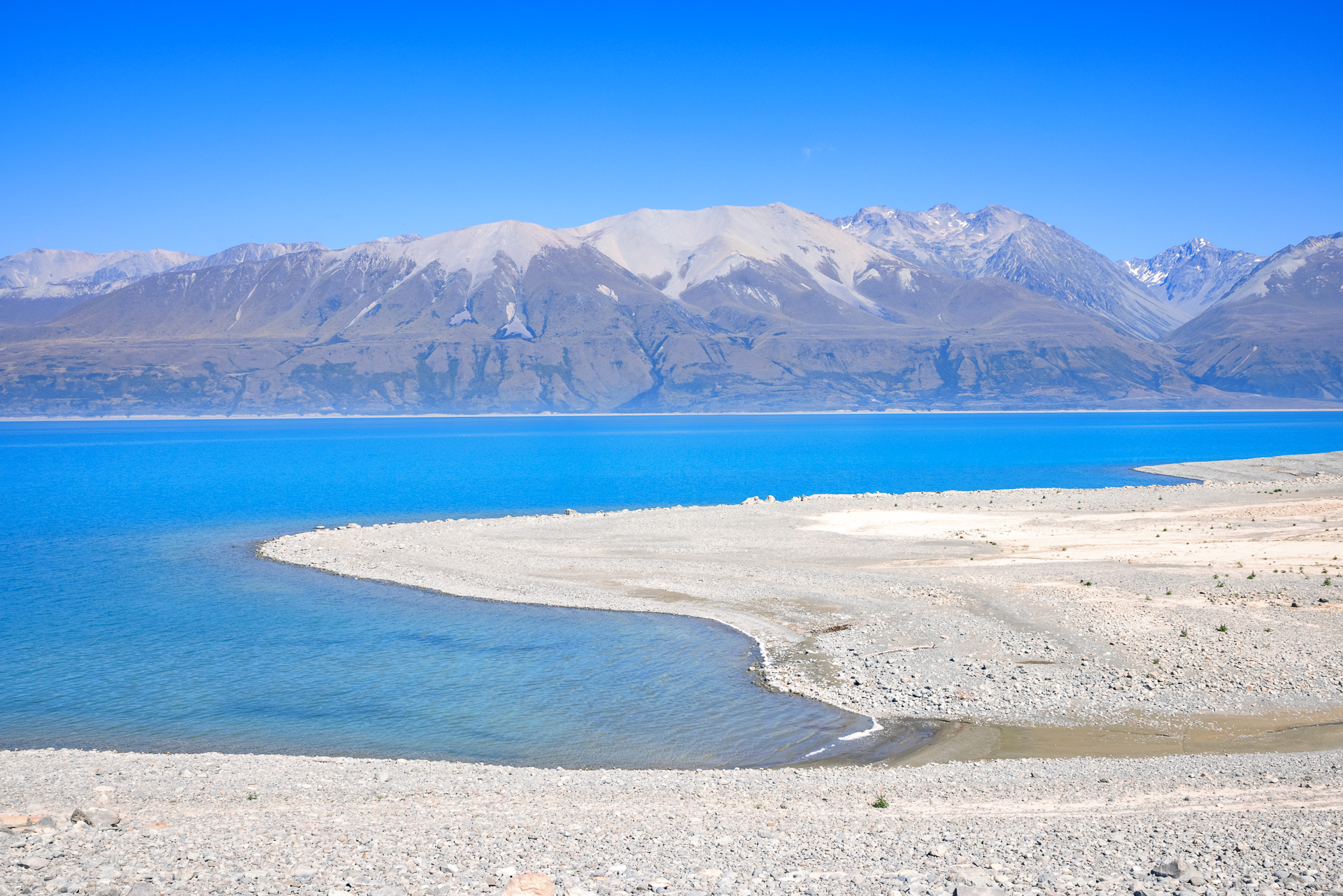
You might see pictures of the bright blue glacial rivers and lakes in NZ and think some clever photo trickery has taken place. They are a take your breath away blue it’s almost unnatural, the water carries limestone sediment that gives it its blue colouring. Blues that change tone as the sun moves and the light changes through the day.
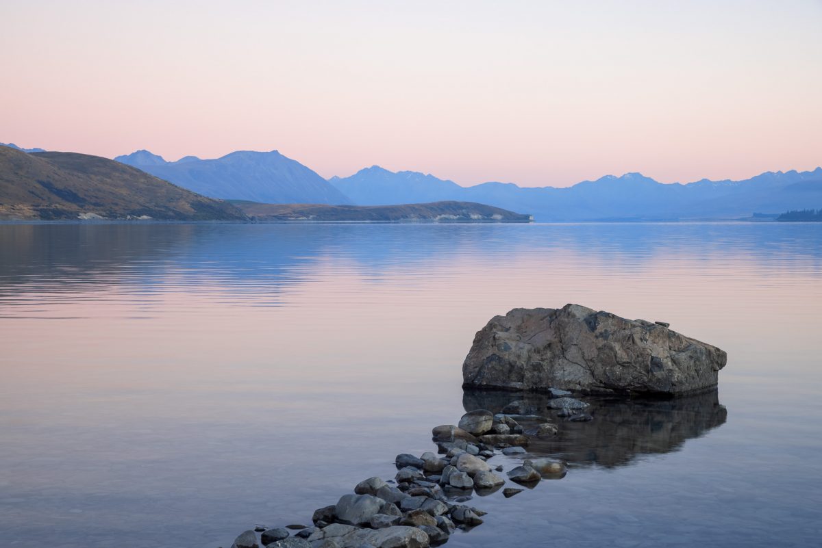
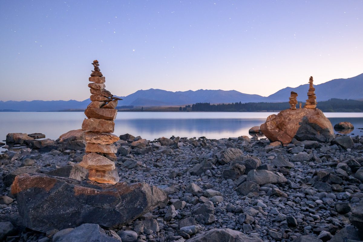
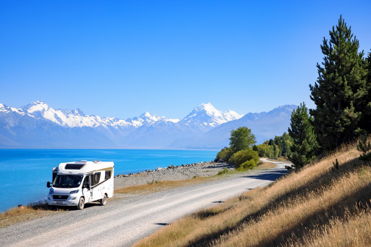
Lake Tekapo
It is another 1.5hr drive from Rakaia Gorge to Lake Tekapo. We were on a tight schedule with the first race of the America’s Cup Prada Cup series starting at 3.15. Chris put our new motorhome through its paces on the road to Tekapo. We drove into Tekapo, gasped at the blueness of the lake, and headed straight into the small town centre to find a bar with TV or WiFi. We lucked out with the bar ‘Our Dog Friday’, which had both, they also happened to be serving excellent burgers, and even better Britannia won both races, result!
Time to enjoy Lake Tekapo. The campsite is right on the side of the lake, with spots overlooking the grey sand beach, blue water and surrounding mountains. The water is calling, and it is lovely, cool, crisp mountain water with no weeds or sticky mud, my kind of lake swimming.
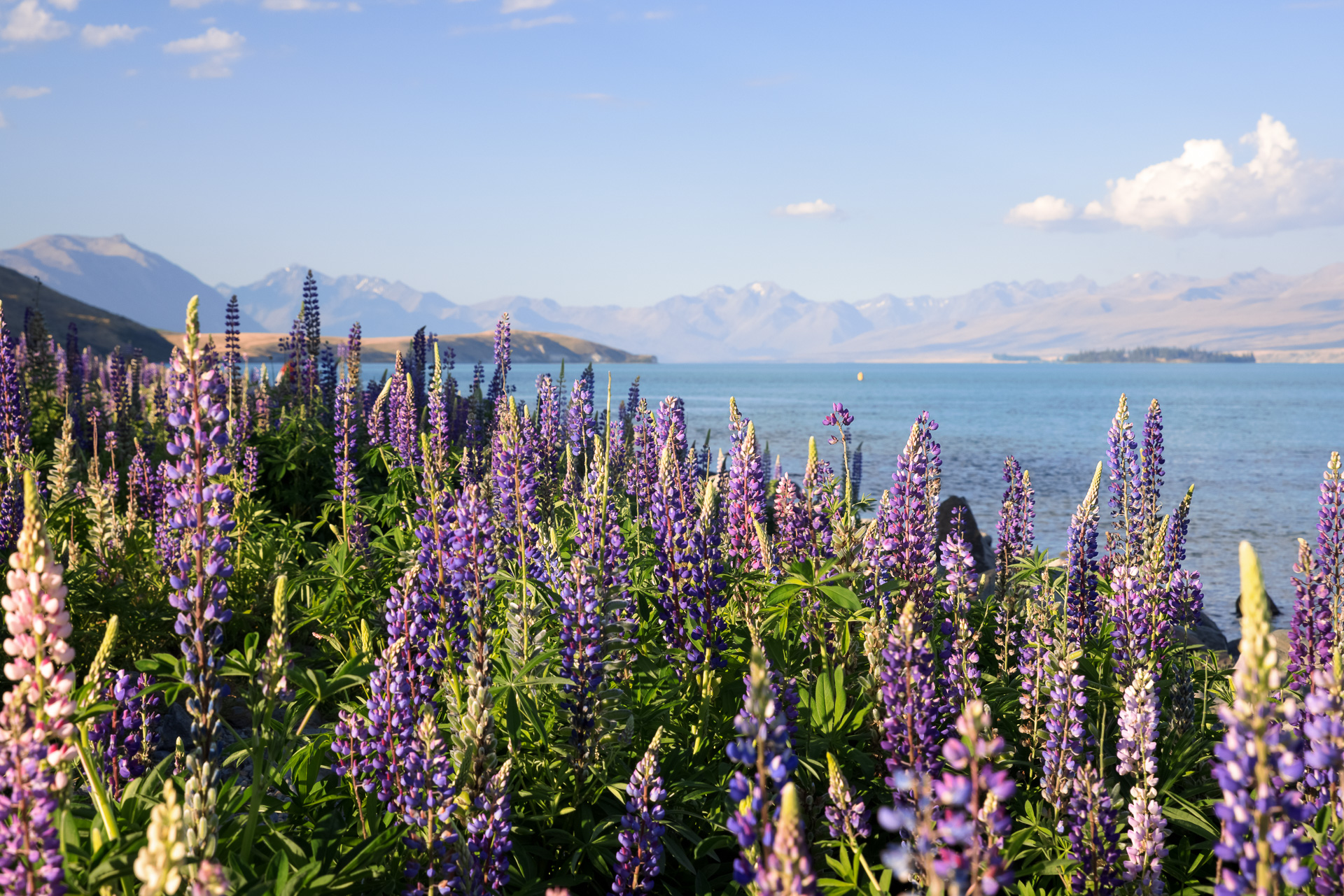
We wandered along the side of the lake for sunset, watching the colours of the mountains change greens, pinks and purple. Purple lupins are all along the rocky shoreline, gorgeous for pictures, but considered an invasive pest species as they thrive in the wild here at the expense of native plants.


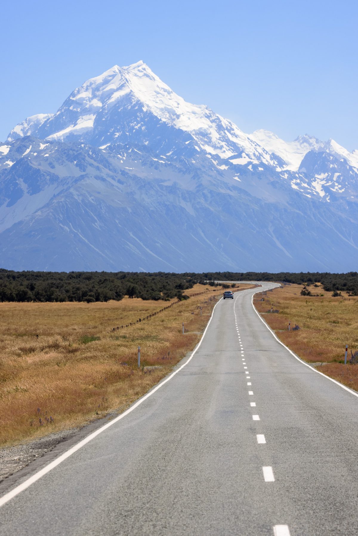
A Spectacular Drive to Aoraki Mount Cook Village
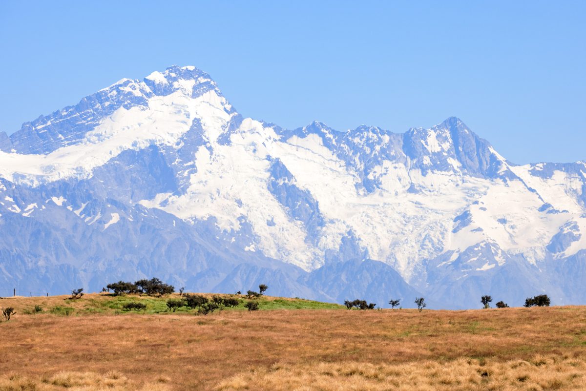
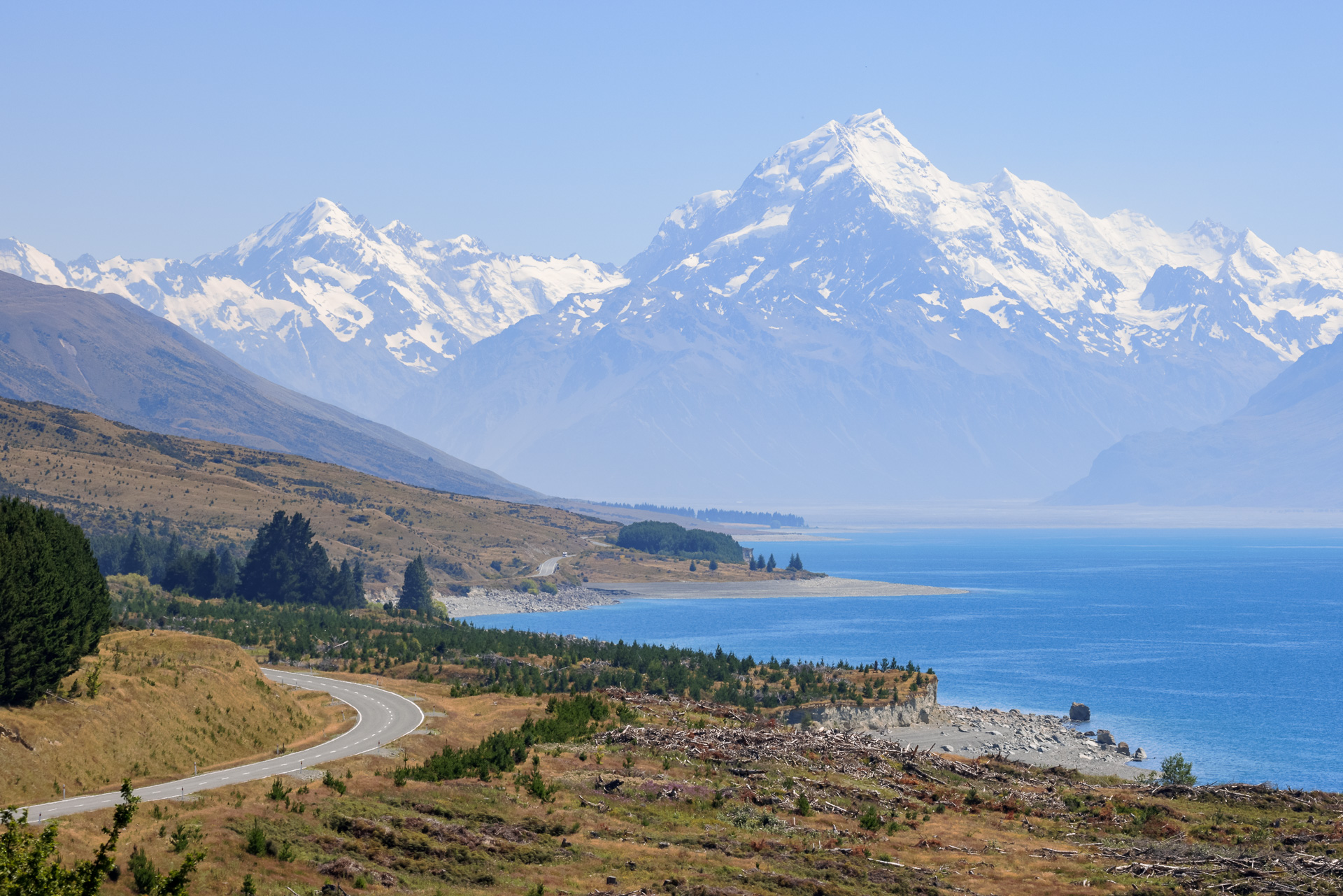
Ideally, this paragraph would start with ‘we woke to blue skies’, but we were both up before daybreak. Chris had already been up since 2.30am photographing the night sky and sunrise, and I had been up since 5am on a Zoom board meeting with the UK. Nonetheless, the sky was blue, and it was a fine day for a drive into the Southern Alps! We took Braemar Road, a gravel backroad that crosses vast tussock grasslands to Lake Pukaki. A spectacular, photogenic drive and the only dust trail in sight was ours. Our destination, the snow-capped Mount Cook comes into view as we approach the divinely blue Lake Pukaki. The road takes us all the way around the lake with multiple stops to admire the stunning views.


The Hikes, Sealy Tarns and Hooker Lake
We park up in the Department of Conservation (DOC) campsite. We have two hikes planned from here. First, a 2.5km, 500m ascent up a steep mountain path to Sealy Tarns, which has great views of the Mount Cook Glacier and the lakes. The path starts out deceptively gentle for the first 1.5km, then becomes fairly steep steps most of the way. I needed frequent pauses, to ‘take in the view’ and catch my breath, and cool down. In the breeze. The sun in NZ is particularly punishing, it has a heat in it to be believed due to the lack of ozone. We paced it back down as wanted to make the start of the Prada races. All in it was a 2.5hr round trip.
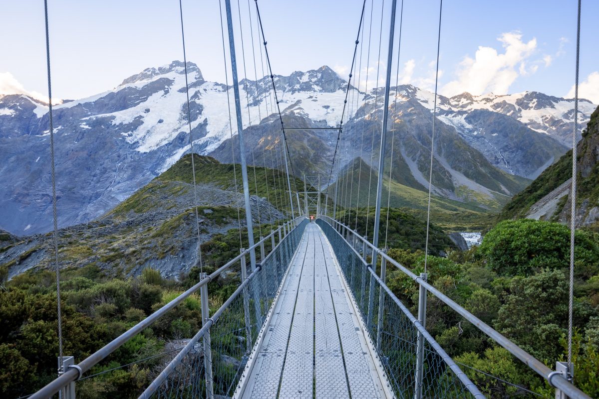
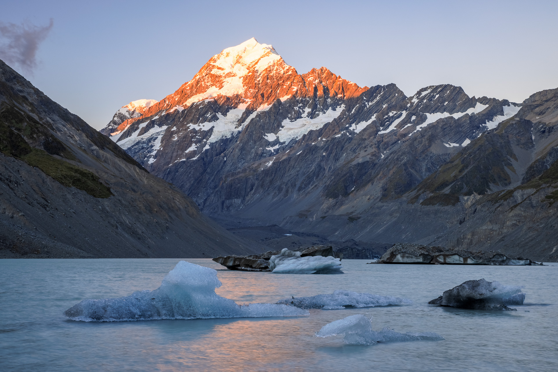
The second a gentle 10km round trip to Hooker Lake which we did after dinner for sunset. A well-maintained trail from the campsite that follows the river from Mueller Lake to Hooker Lake. You cross the river three times on swing bridges across the river, the second one is quite spectacular, it is long and high and crosses some rapids towards Mueller Lake. Walking this path you start to see the effects of climate change on the Southern Alps, the glaciers above the lakes are retreating fast. Glaciers that were once huge tourists attractions for their scale now look quite small.
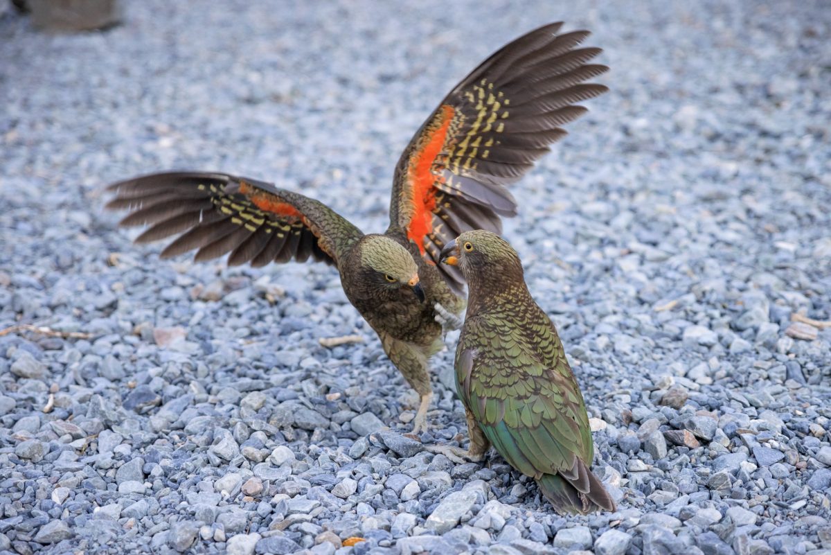
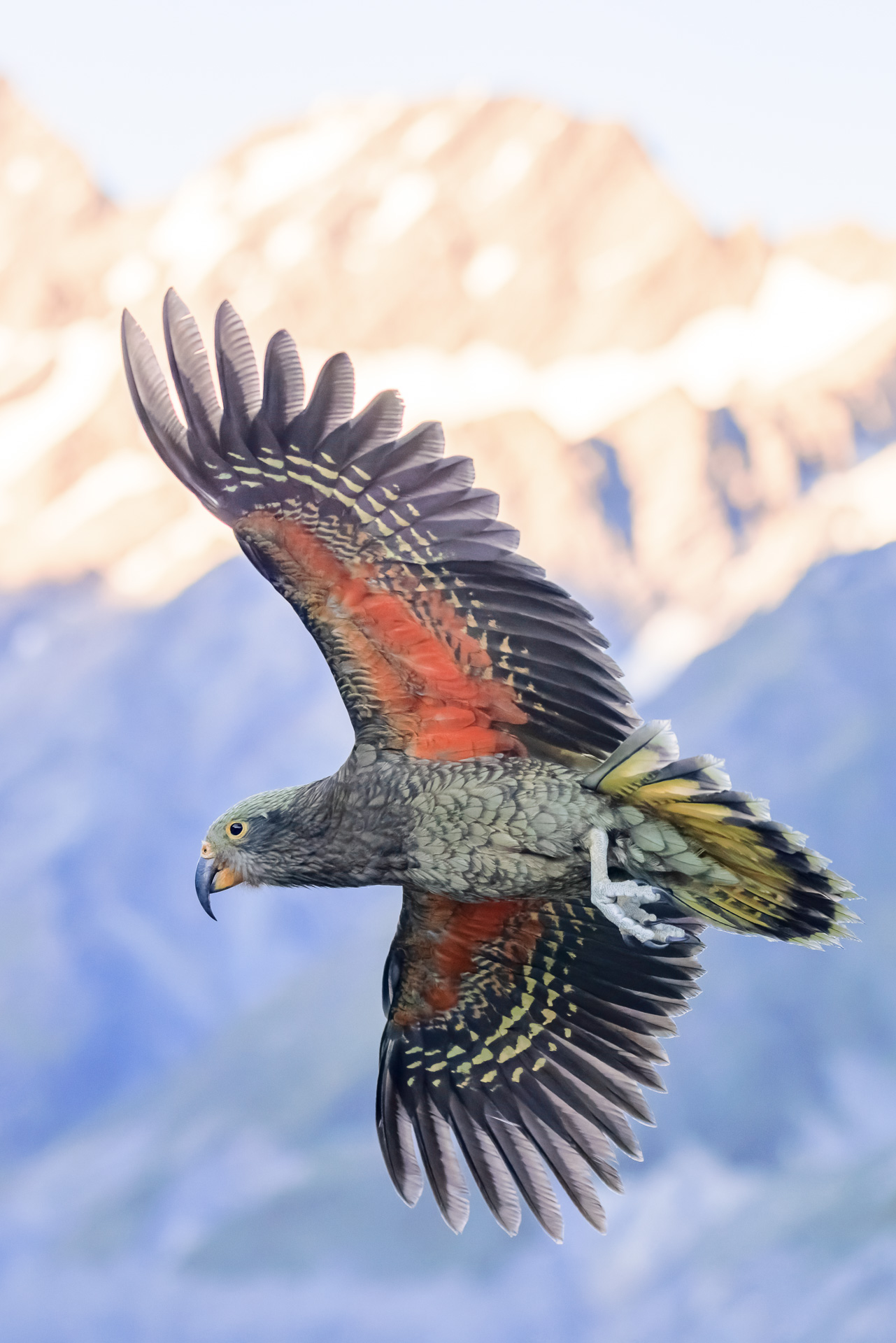
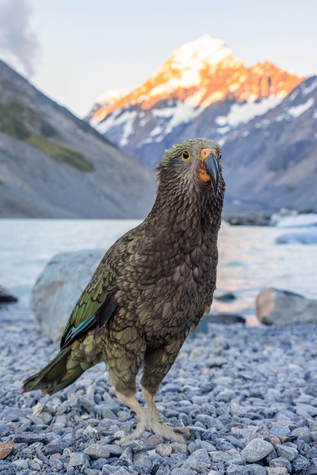
At the picnic area and on the beach, we found some kea, the world’s only alpine parrot. Very inquisitive, they are keen to have a dig around your backpack, checking out what the zips taste like. They seemed to have a particular fascination with the rubber feet of Chris’s tripod. I had brought my bikini with an optimistic view to having an evening dip. The plan changed when I saw the blocks of ice that have carved off the glacier and are now melting slowly into the lake. Bikini stayed firmly in bottom of the backpack, my thermos of wine was opened instead for a sundowner as we sat on the beach to watch the sun setting.


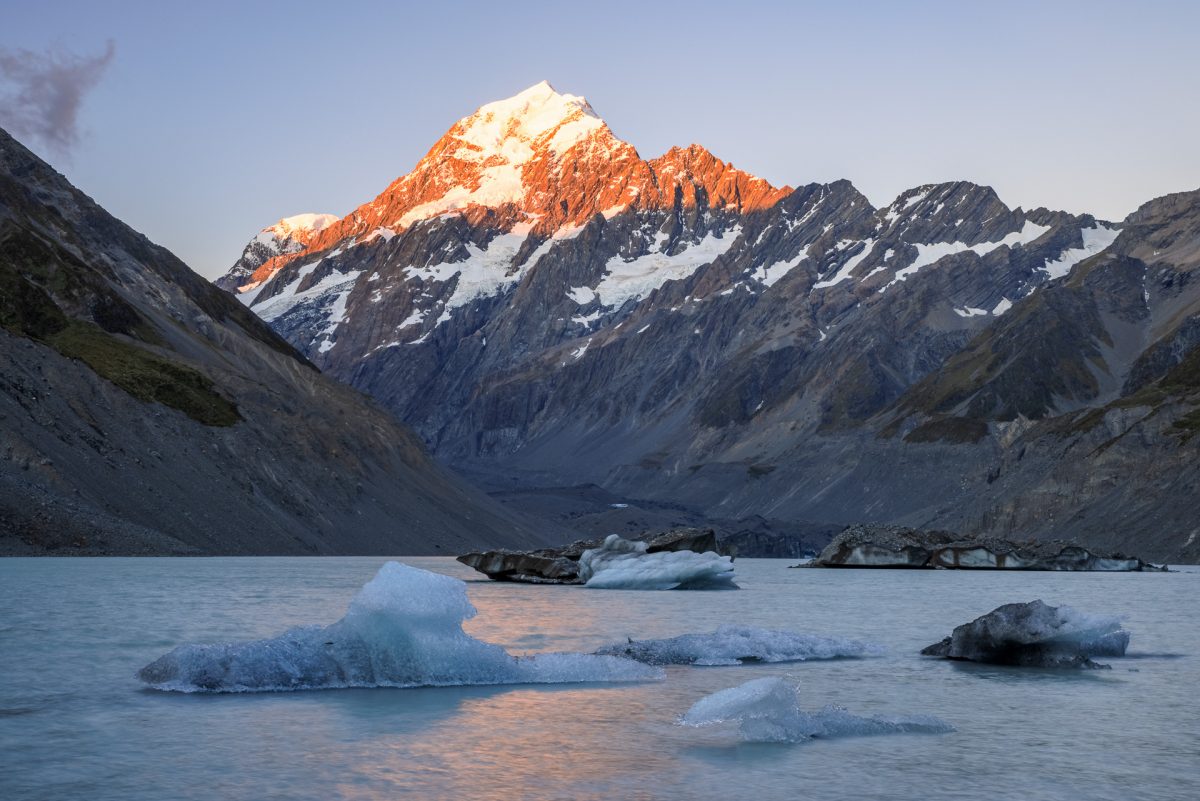
The next morning we walked to the Tasman Glacier lookout. This glacier is melting rapidly due to climate change, at an average rate of 180m per year since the 1990s, so far having lost around 30% of its ice. The glacial Tasman Lake has formed as a result of the glacial melt in the last 40 years and is now more than four miles long, and around 240m deep.
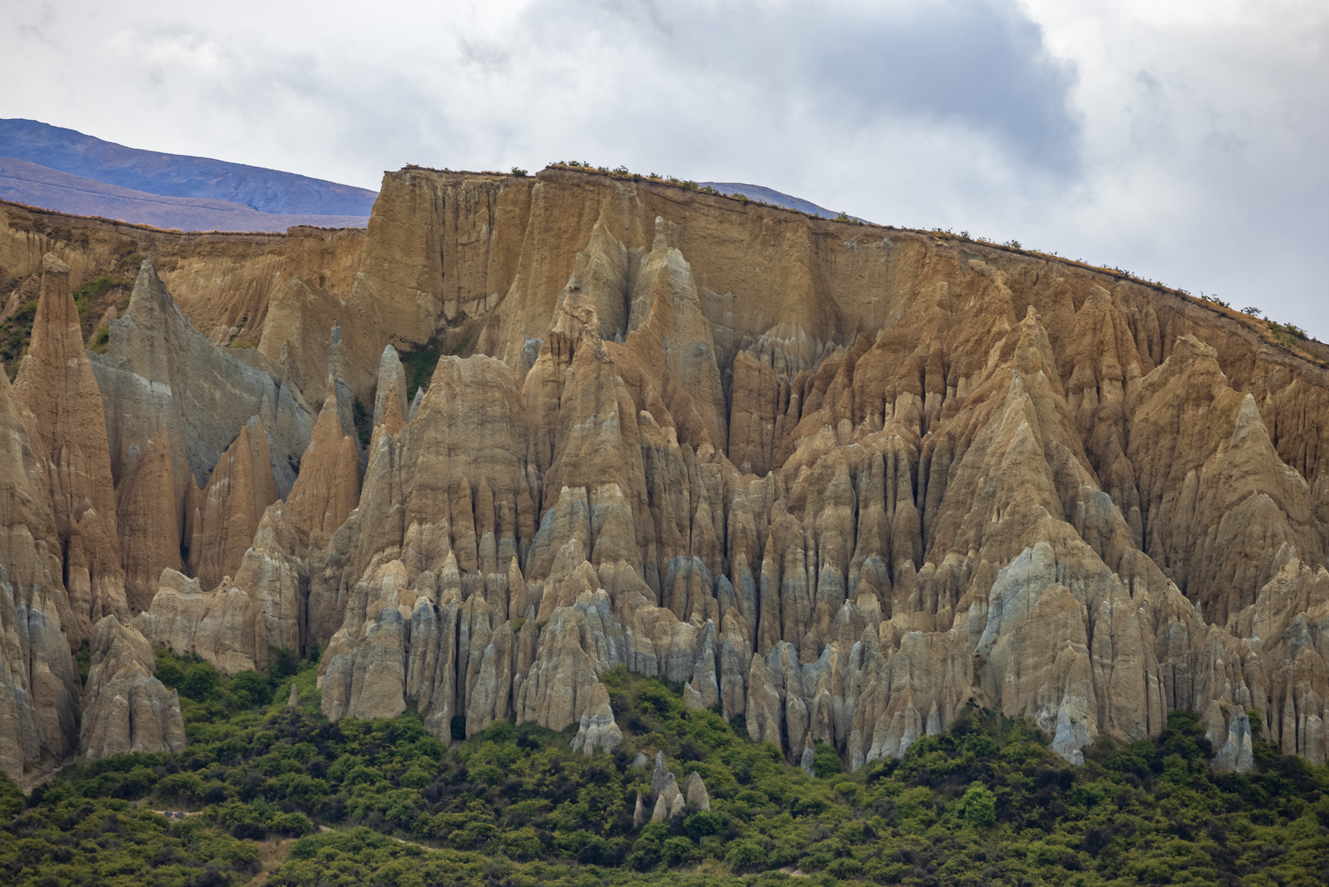
The Clay Cliffs, Omarama
We took in the clay cliffs on route to Lindis Pass, apparently a classic example of ‘badlands terrain’. The whole area used to be a lake. The layers of sandstone sediment that were the lake bed have now eroded with the weather to form extraordinary corridors, ledges and turrets of sandstone. You could spend hours exploring this. But guess what? We had a Prada Cup race to catch. In Omarama we found the only bar in town, not a soul inside. So the bar lady was more than happy to switch the cricket over to the sailing.


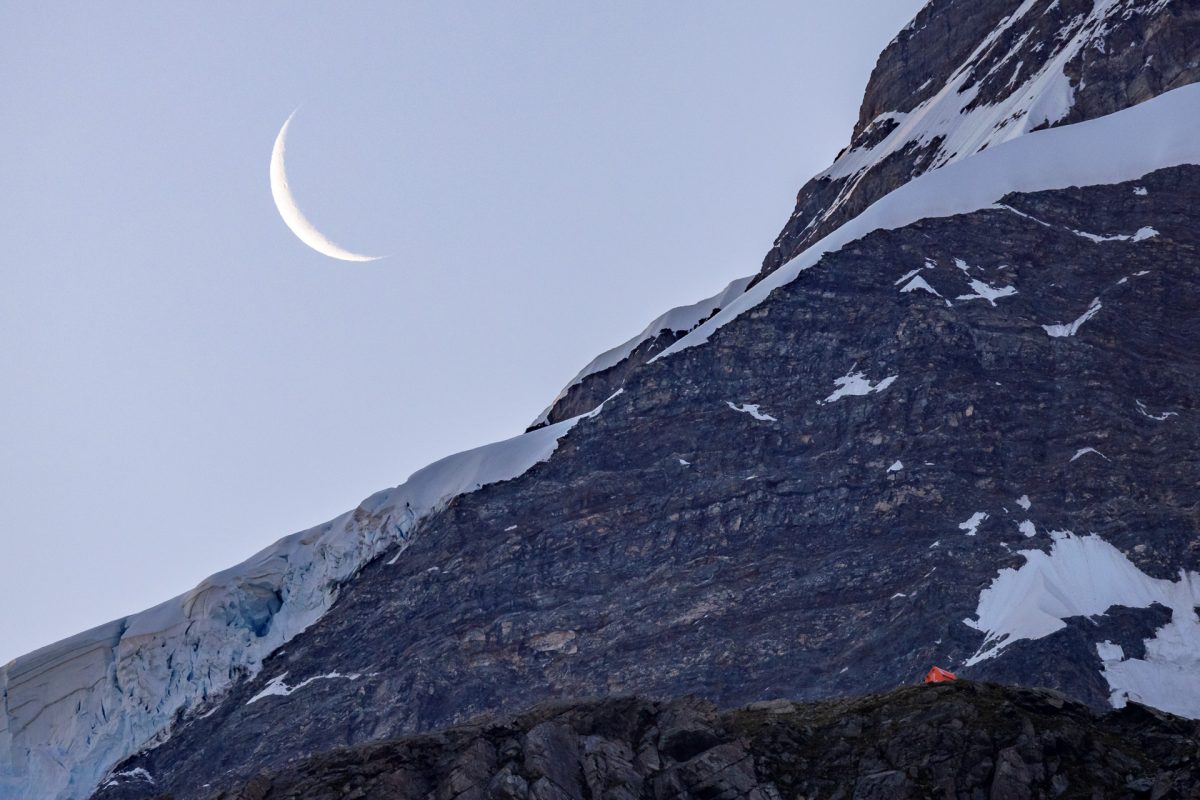
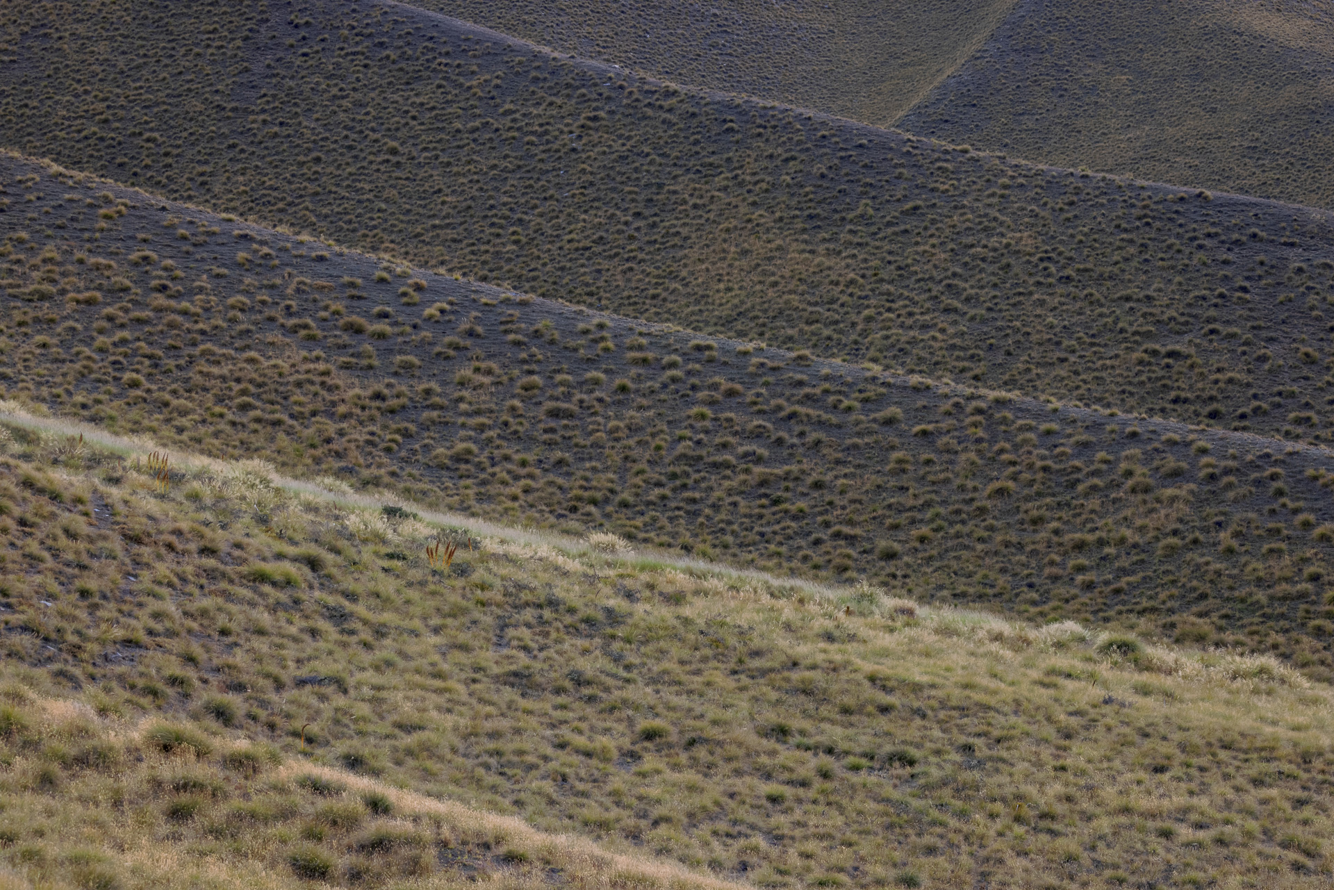
The landscape after Omarama changes again to rolling hills with tussocks and lichen, slightly reminiscent of the Scottish Highlands. We had picked a wild camping site (the Old Hotel?) for the night that was near Lindis pass so we could climb one of the hills for sunrise in the morning. As we arrive, Chris explains, wow you never see ruins in NZ, everything is new or made of wood. This whole area was part of the gold rush in the late 19th Century and this particular hotel, now stone ruins in a campsite used to be the general store as well as having a few rooms for travellers.
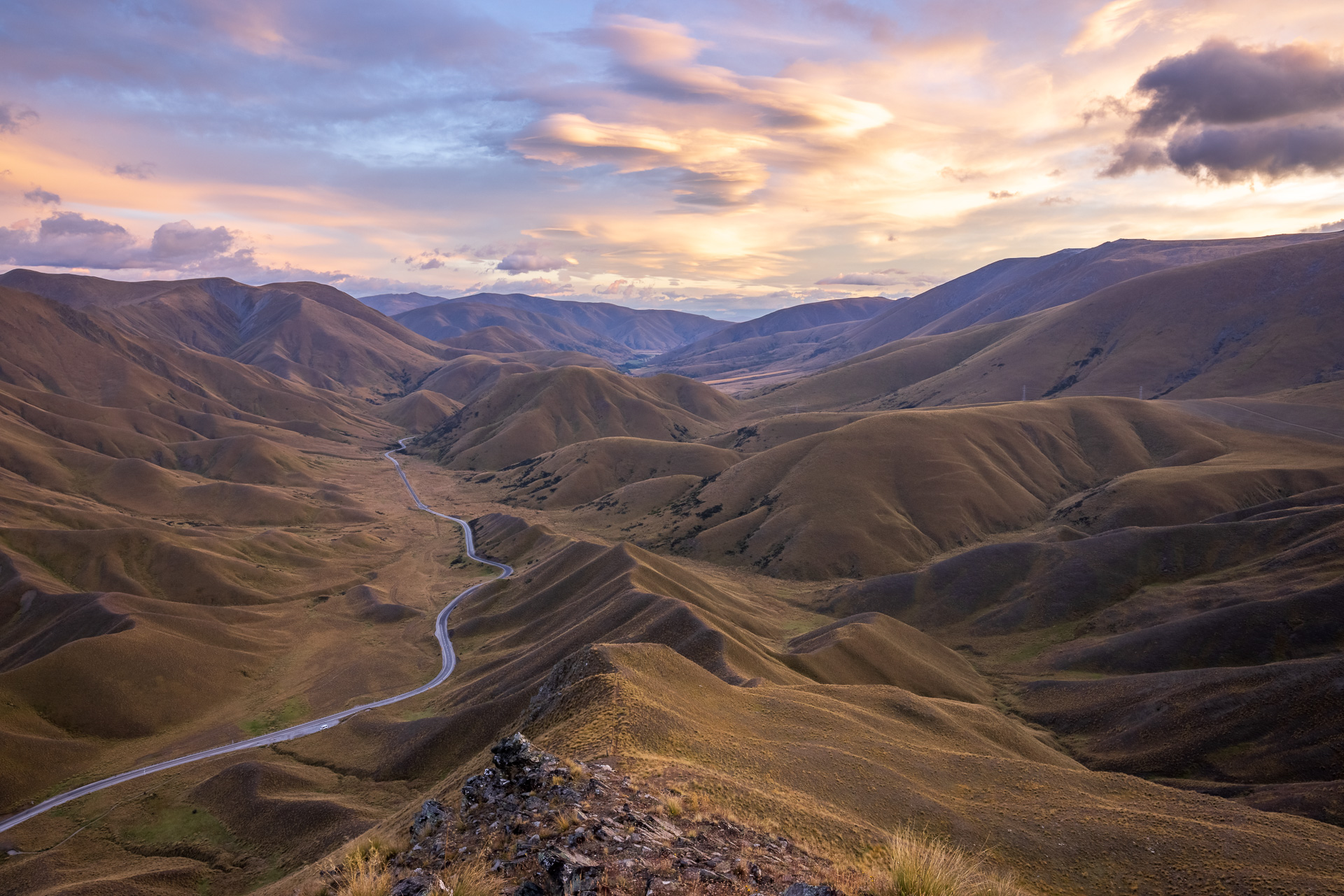
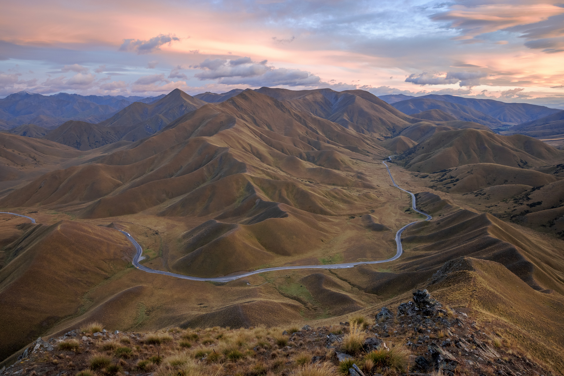
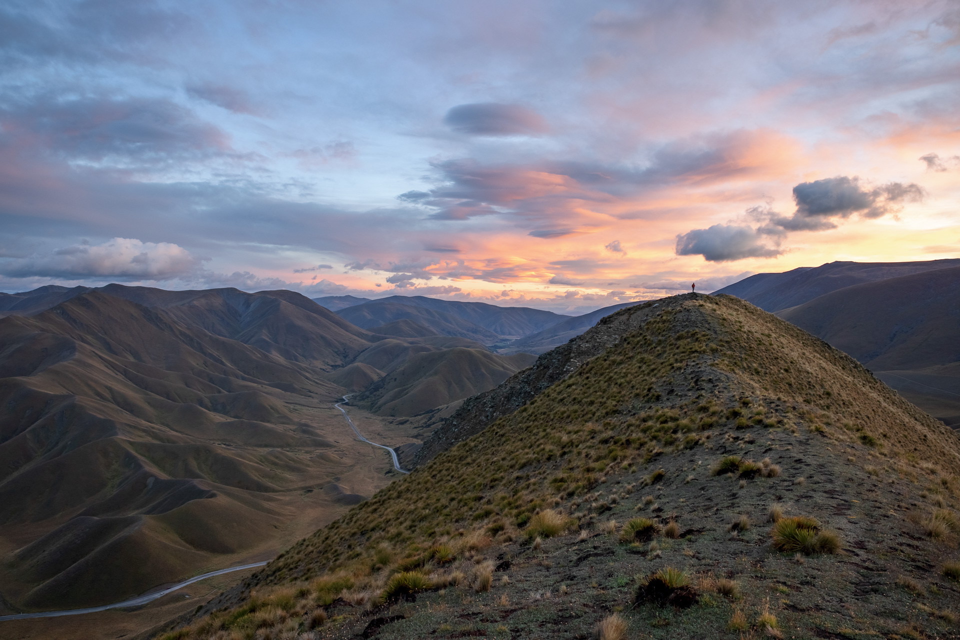
Sunrise at Lindis Pass
The alarm went off at 4.30am. Early up, for the sunrise hike, a 350m ascent mostly along a ridgeline. We set off in the dark but having seen the path the night before we thought we knew what to expect. Did we hell, it turned out to be one of those hikes when you think you know where the top is, always just over the next lip. Three times, I dragged my burning thighs up to what I optimistically thought was the summit. Calling out for Chris, who is always slightly ahead, heart sinking as I spot Chris’s headlamp halfway up another ridge. Muttering swear words, and mustering more energy I keep going. Finally, as the sunrise is starting to light up the clouds, I reach the top and celebrate by cracking open my thermos of tea. Thigh burn swiftly forgotten as my breathing steadies and I can take in the panoramic views of the hills. The sky is firing up pinks and reds with the sunrise, gorgeous light on the hills, showing up the folds like velvet.


We descended fast for a well-deserved nap looking forward to lunch at one of the nearby Otago wineries. Thank you, Dave, for the recommendation.


Those bridges! Spectacular.
Amazing x
WOW !! Looking forward to the next Chapter
Wow this looks amazing. Hope you’re having a brilliant time
We are having an incredible time, amazing country and lovely people!